Showing posts with label state highpoint. Show all posts

Friday, June 28, 2013

Surviving Mount Sunflower

Prior to reaching Colorado during a road trip in 2009, my wife and I decided we would finally take the side trip off I-70 to conquer Mt. Sunflower, the highest point in the state of Kansas.

Scaling a formidable peak such as Mt. Sunflower requires meticulous planning. Prior to embarking on our expedition we lined-up sponsors, hired Sherpas to set-up a base camp, and packed away plenty of Diamox to help ward off bouts of altitude sickness.

After spending as much time as possible at base camp, acclimating to the thin air at the lofty elevation of 4026 feet, we launched into our high adventure with all the usual mountaineering accoutrements; balaclavas, avalanche beacons, ropes, crampons, ice axes, two-way radios, and most importantly, bottled oxygen. Although we fully intended to attempt the summit without supplemental oxygen, our Sherpas stashed several tanks at high camp just in case either one of us ran into any emergencies near the summit.

During the planning process, one of our biggest fears was the possibility of encountering one the rogue storms that buffet the slopes of Mt. Sunflower on a regular basis. Fortunately for our team, this particular day was relatively calm.

Yes, Mt. Rainier has its Disappointment Cleaver, and Mt. Everest has its Hillary Step, but Mt. Sunflower has the infamous Jayhawk Traverse which climbers must negotiate along the peak's Northeast Face. At an elevation of 4031 feet, this is one of the most treacherous sections on the entire mountain - a place where many have perished over the years. Here’s a view of the deep canyon that lies below the Jayhawk Traverse (although I fumbled with my camera with numbed hands and fingers, I was still able to shoot this as we pressed on through the oppressive atmosphere):


At 4034 feet I took this shot of one of the endless number of false summits we had to contend with - all the while being exposed to the "death zone":


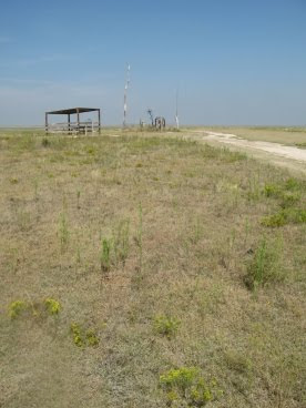
After numerous false summits, too many to keep track of, the face of the dreadful peak finally comes into view. Here's what we saw as we made our final approach to the summit:


Suffering from extreme exhaustion, hypoxia and Acute Mountain Sickness, our team finally arrived at the 4039-foot summit. At last, we had conquered the savage mountain!

It was at this time that I recalled some sage advice from world famous mountaineer, Ed Viesteurs: "Getting to the top is optional, getting down is mandatory". This bit of wisdom and guidance was now weighing heavily on my mind. The reality of the situation was that we were only at the half-way point:

So you may be asking yourself: Why would anyone climb Mt. Sunflower? The only reason I could think of in my oxygen-starved mind was simply, because it was there...

The expedition didn't escape without incident, however. On our return to base camp, while traversing the western edge of the Konza Glacier, I slipped on some rotten ice. Just in the nick of time I was able to self-arrest with my ice axe. I literally touched the void at that moment. Another second or two and I would've fallen to the bottom of the Prairie Couloir.

All in all the expedition proved to play an important roll in helping us train and acclimate for our next big adventures in Rocky Mountain National Park!

--------------------------------------------------------------------------------------------------------------------

Mt. Sunflower, my 14th state highpoint, is located on the far western border of Kansas on the Harold Family Ranch in Wallace County. The most difficult part about reaching the summit for would-be "climbers" are the 20+ miles of un-paved roads you have to drive on. As long as it's not wet, the roads are fine for two-wheel drive vehicles.


Driving Across Kansas - Guided by authors Ted Cable and Wayne Maley, the historical landscapes of I-70 come back to life, recalling landmarks and legacies relating to pioneer movements and Indian dispossession, army outposts and great bison hunts, cowboys and cattle trails, the struggles over slavery and women's rights, and the emergence of major wheat, beef, oil, and water industries.Their guide parcels out information, mile-marker by mile-marker, in a way that's equally accessible to westbound and eastbound users alike.


Thursday, June 27, 2013

Guadalupe Peak: The Top of Texas

After staying in Van Horn the night before, Kathy and I made the 60-mile drive north to Guadalupe Mountains National Park in the early morning darkness. My goal was to arrive just outside of the park in order to a get a photo of El Capitan, just as the sun begins to shine on the dramatic east face of the mountain that stands at the southern terminus of the Guadalupe range.

With an elevation of 8,749 feet, Guadalupe Peak is the highest point in Texas, and, is the 14th highest state highpoint. It’s also one of only four state highpoints that are located within a national park - Denali, Mount Rainier and Clingmans Dome being the other three.

The hardest part of the hike is at the very beginning in which the trail ascends a series of switchbacks over the course of the first mile-and-a-half or so. Hikers can use the parking lot and the state highway to gauge their progress.

During this first section the trail climbs the east face of the peak, which means hikers are fully exposed to the hot desert sun. I highly recommend starting this hike before sunrise in order to knock-out as much of this section as possible during the relative cool of the morning. It's also a good idea to start early so that you’ll have time to get off the mountain before summer afternoon thunderstorms arrive.

At roughly 7000 feet in elevation, and 1.7 miles from the trailhead, the trail skirts a relatively narrow ledge. Although not exceedingly dangerous, you'll still want to take your time through this short section of trail. Just beyond this point the switchbacks mercifully come to an end (although they'll inflict more pain on the way down). Soon the trail winds around the other side of the mountain and reaches some much appreciated shade. From here the grade becomes much easier and remains relatively moderate for the rest of the hike.

As we traveled upward we saw numerous Northern Harriers flying just above us. Up at the summit we also saw a few Golden Eagles and a couple of Peregrine Falcons soaring and gliding on the thermal updrafts.

At the second cliff section:

The photo above includes a young man from New Zealand and his girlfriend getting ready to cross the highest bridge in Texas. Just days before a 7.1 magnitude earthquake hit near his hometown just outside of Christchurch. It took a day or two, but he finally received confirmation that his entire family was alright. He said his dad, who happens to be a building inspector, was keeping extremely busy in the aftermath of the quake. The young Kiwi was working as a rafting guide on the Pigeon River in Tennessee.

Just past the bridge we began the final climb to the top. Over the last quarter-of-a-mile route finding became a little difficult. We made the same mistake a guy in front us made by missing the trail as it heads-off towards the right. Consequently, we took a route that required a little bit of scrambling. No big deal, it just would’ve been easier had we stayed on the main trail.

At the summit is a stainless steel memorial that was erected by American Airlines in 1958 to commemorate the 100th anniversary of the Butterfield Overland Mail Route, a 2800-mile stagecoach route that passed along the south side of the mountain. On one side of the pyramid is the American Airlines logo. Another side displays a U.S. Postal Service tribute to the Pony Express Riders of the Butterfield Stage, while the third side displays a compass with the logo of the Boy Scouts of America.

From the summit we could see a line of thick high clouds extending from one end of the horizon to the other in the far off distance (they say you can see more than 100 miles away). These were likely the leading bands of Hurricane Hermine that was pummeling central and east Texas that day.

Although the hurricane had no impact on our hike, hikers should always expect high winds on the mountain – especially during the winter months when winds can exceed 80 MPH on a fairly regular basis.

Looking towards the north from the summit:
Looking down on El Capitan and Highway 62/180 far below:
The park also recommends that you take a full gallon of water. I only took about 100 ounces, thinking that would be enough given the relatively cool weather that day. I barely had enough, however. During peak summer months I would definitely take the parks’ recommendation of one full gallon.

One final note about this part of the country: After our hike we had planned to attend the Evening Star Party at the McDonald Observatory 65 miles south of Van Horn. Every Tuesday, Friday and Saturday the observatory invites the public to view the universe through 16 and 22-inch telescopes located atop Mount Locke and Mount Fowlkes (6300-6800 feet). This observatory in the remote Davis Mountains offers some of the darkest night skies in the continental United States. Unfortunately Hurricane Hermine wasn’t going to allow that to happen that night. As the early evening progressed the clouds continued to thicken, so we decided to cancel our plans. However, we did hear a lot of great things about the program and sounds like it would be a great excursion if you’re in the area.


Trail: Guadalupe Peak Trail
RT Distance: 8.5 miles
Elevation Gain: 2927 feet
Max Elevation: 8749 feet
TH Location: Pine Springs Campground near the Visitor Center
Map: Guadalupe Mountains NP Trails Illustrated Map


Hiking Carlsbad Caverns & Guadalupe Mountains National Parks - is the only comprehensive guide to all thirty-six trails — both underground and above ground — in these two national parks. From deep caverns, to high peaks and backcountry canyons, these parks provide the perfect backdrop for an unforgettable experience.