“It is by far the grandest of all the special temples of Nature I was ever permitted to enter.”
- John Muir on describing Yosemite
Although the name would imply that this is a 4-mile hike to Glacier Point, the Four Mile Trail is actually 4.6 miles in length. Construction of the original trail was completed in 1872, but over the years it’s been slightly rerouted and lengthened to moderate the grades and make them less steep. I guess changing the name now to the “4.6 Mile Trail” just wouldn’t have the same cachet.
The hike begins from bus stop E5 on Southside Drive under the imposing gaze of Sentinel Rock. There’s enough room for roughly 20 cars to park alongside the road at the trailhead. You’ll also have the option of parking near Yosemite Village and walking to the trailhead, or taking the free El Capitan bus shuttle.
We began our hike fairly early in the morning, just as the sun was hitting the south facing walls on the north side of the valley. The smell of smoke from the Rim Fire was already wafting through the air.
Just as the trail began to tilt upward we saw a black bear roughly 50 yards up trail, standing just off to the side. We stopped and stared at each other for about 30 seconds, until the bear decided that we really weren’t all that interesting, or we weren’t a threat, and then promptly disappeared into the forest.
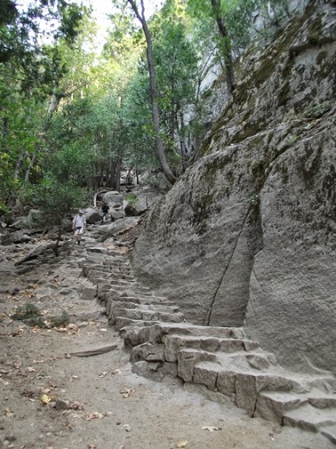
Less than a hundred yards from the road the trail begins its relentless climb up to Glacier Point. As the trail climbs along the dozens of switchbacks you’ll have some outstanding views of the western end of the Yosemite Valley, including the Cathedral Spires and El Capitan, the largest exposed granite monolith in the world. Climbers from all over the world come to climb this towering rock formation that stands 3593 feet above the valley floor.
During the warmer months of the year I highly recommend starting your hike as early in the morning as possible, in order to take advantage of the shade you’ll have during much of the climb.
Roughly a mile from the trailhead you’ll begin to have your first full views of Yosemite Falls. The lower-to-mid portions of the Four Mile Trail are the only places in Yosemite National Park where you can see the entire waterfall from top to bottom, when it’s flowing during the spring and early summer months.
At roughly 2.7 miles you’ll have your first views of Half Dome. Continue on for another three-tenths of a mile where you’ll reach a short side trail that leads to Union Point. From this vantage point at roughly 6350 feet you’ll have outstanding views of almost the entire Yosemite Valley, including Yosemite Falls.
Once above Union Point the smell of smoke became more apparent. The haze was fairly visible towards the west, but looking towards the east we still had blue skies up above. At this point we were still holding out hope that we would have unimpeded views from Glacier Point.
Although there are a couple very short sections where the trail is exposed to some steep drop-offs, the path is fairly wide, and is pretty safe from my perspective. At no time did I feel uncomfortable, nor did Kathy, who has a much stronger fear of heights than I do.
At 4.6 miles the trail reaches the gift shop & cafeteria at Glacier Point. To continue on towards the overlook, take a left and walk another tenth-of-a-mile.
Extreme disappointment would probably be an accurate description of my feelings upon reaching Glacier Point. We had planned this hike several months in advance, but to see the entire Yosemite Valley shrouded in haze after finally arriving was unquestionably a major let down. During the late summer and early fall of 2013 the Rim Fire would burn more than 257,000 acres along the western edge of Yosemite National Park, and in the process, would become the third largest wildfire in California history.
Normally from this overlook perched at 7200 feet you’ll see the iconic view of Half Dome, North Dome, Basket Dome, the Royal Arches, Tenaya Canyon and Yosemite Falls. Dominating the landscape from this vantage point is Half Dome, which tops out at 8836 feet, and rises almost 5000 feet above the valley floor.
The Yosemite Valley was one of the first federally protected tracts of land in the world. In 1864 Abraham Lincoln signed the Yosemite Grant, which deeded the Yosemite Valley and Mariposa Grove to the state of California for protection as a forest reserve. Due to concern over damage from livestock and logging, John Muir led a movement to establish a larger national park that encompassed the surrounding mountains and forests. However, when Yosemite National Park was established on October 1, 1890, it excluded the Yosemite Valley and Mariposa Grove. In 1903 Muir took President Theodore Roosevelt on a three-day camping trip near Glacier Point. During this trip Muir convinced Roosevelt to take control of the valley and grove away from California. Finally, on June 11, 1906, Roosevelt signed a bill that would merge the Yosemite Valley and Mariposa Grove with Yosemite National Park.
On this day we continued our hike back down the valley via the Panorama Trail. In addition to hiking the combined Four Mile and Panorama Trails for a spectacular one-way, 12.6-mile hike, you’ll also have a couple other options for tackling this trail. If you have two cars in your party you can park at both ends of the trail and hike in either direction. You can also take the Glacier Point Tour bus, which provides hikers with a one-way shuttle. This option will allow you to take the bus up to Glacier Point and then return back down to the valley via the Four Mile Trail. You could also hike up the trail and then catch the bus on your return trip to the valley. There is a fee for this service.
If you decide to combine the Four Mile and Panorama Trails, the free shuttle service in the valley can be used to bridge the distance between the two trailheads. You may also want to note that you can purchase snacks and drinks from the Snack Stand at Glacier Point. If you’re going to depend on this for re-fills and refueling on your hike, make note of their open hours. Well water from a spigot is also available at Glacier Point, though it’s not the best tasting water in the world.
Trail: Four Mile Trail
One-Way Distance: 4.7 Miles
Elevation Gain / Loss: 3235 feet
Max Elevation: 7214 feet
TH Location: Four Mile Trailhead in the Yosemite Valley
Map: Yosemite National Park Trails Illustrated Map
Top Trails: Yosemite features 46 “must-do” hikes in Yosemite National Park, from scenic strolls, to full-day adventures, to spectacular backpacking trips. With at-a-glance information for each hike visitors can determine which hikes are most suitable to their skills, schedules and preferences. The book also provides elevation profiles, detailed maps, as well as information on which trails are child-friendly; where to see giant sequoias, waterfalls, lakes, wildflowers, autumn colors; the best photo opportunities; and which have camping, running or biking opportunities.
Showing posts with label Yosemite Valley. Show all posts
Thursday, September 26, 2013
Sunday, September 22, 2013
Sentinel Meadow & Cook's Meadow Loop
There are several locations where hikers can access the Sentinel Meadow & Cook's Meadow Loop. We chose to begin our hike from the Sentinel Bridge parking area, located just behind bus stop 11 on Sentinel Drive.
Hikers will also have the option of hiking the loop in either direction. In general, hiking the loop in a clockwise direction is a little bit easier to navigate. However, if you’re starting in the early morning and wish to avoid the crowds at the Lower Yosemite Fall viewpoint, I would definitely recommend hiking in a counter-clockwise direction. This hike description follows the loop in a counter-clockwise direction.
The absolute best time to hike this easy loop is during the spring and early summer months when the meadows are lush green, Yosemite Falls is thundering down the valley wall, and the wildflowers are blooming. As you walk through the meadows keep an eye out for shooting stars, western azalea, pine violets, evening primrose, baby blue eyes, larkspur, goldenrod and woolly mule-ears, among many other varieties.
The hike begins by following the Cook’s Meadow Loop trail northward until it crosses over Northside Drive. As you might expect, the views of the Yosemite Valley are outstanding here. During the spring and summer the meadow is carpeted in wildflowers. You’ll also have an excellent chance of seeing deer – we saw several throughout the day.
The loop then makes a left turn and crosses over Village Drive. Here you’ll begin following the paved path alongside Northside Drive. The unfortunate aspect of this otherwise wonderful hike is that you’ll have to contend with noise from traffic and buses along much of the route.
Just before reaching bus stop 6 you’ll arrive at the Lower Yosemite Fall Trail junction. Take a right here to visit one of the tallest waterfalls in the world. Yosemite Falls drops 2425 feet in three separate sections, and depending on which source you want to believe, is anywhere between the 5th tallest and the 20th tallest waterfall in the world.
During our visit the waterfall was completely dry. Because it’s fed by snowmelt, peak flow usually occurs in late May, and usually stops flowing altogether by late August.
The Lower Yosemite Fall Trail makes a semi-loop to an up-close viewpoint of the lower fall, and then exits on the west side of bus stop 6. The trail passes through a very pleasant forest, and is a nice diversion from the noise of the road. However, I imagine when the falls are flowing it gets pretty crowded here.
After leaving the Lower Yosemite Fall Trail you’ll cross over Northside Drive and begin heading over towards the Yosemite Lodge. When you get into the village there will be a residential area for employees on the left. Look for a bike path that veers off to the left before you get to the lodge. There won’t be a sign indicating that it’s a bike path, but it’s the only such trail in the residential area. From here the paved path traverses along the southern edge of the lodging area, before taking you into the heart of Leidig Meadow where you’ll have some outstanding views of the western end of the valley, including Sentinel Rock and El Capitan. Sentinel Falls, at 2000 feet and among the world’s tallest waterfalls, is also visible from this meadow. Despite its height it has a relatively low flow, and is usually dry by July.
The prominent view to the west is known as the Gates of the Valley. On the left are the Cathedral Spires, and to the right is El Capitan, the largest exposed granite monolith in the world. Climbers from all over the world come to scale this vertical rock that towers 3593 feet above the valley floor.
Soon the trail reaches the Merced River where you’ll cross over the famous Swinging Bridge. The views looking upstream towards Yosemite Falls and the eastern end of the valley are simply sublime – even when the falls are dry.
At the beginning of 1997 the park experienced its worst flood ever. As the Merced reached a crest of 23.4 feet, it destroyed roads and buildings that resulted in $178 million in damage, and stranded 2100 park visitors for several days.
Once you cross over the bridge the trail begins heading east along Southside Drive. This section of the loop also provides outstanding views of Yosemite Falls during the spring and early summer months. The meadow to the north of the road here is known as Sentinel Meadow.
Continue to follow the paved bike path all the way to the Yosemite Chapel, which is located near the Sentinel Drive junction. Built in 1879, the chapel is the oldest structure in the Yosemite Valley.
Roughly 35 yards beyond the chapel you’ll reach the Cook’s Meadow Loop trail. As the name would imply, the trail ventures into the heart of Cook’s Meadow. Once again you’ll cross over the Merced River, and soon will reach another trail junction where you’ll take a right to return back to the Sentinel Bridge parking area.
The Cook’s Meadow Loop travels over a raised boardwalk, which was put in place to enhance water flow, and ultimately return the meadows to more of a wetland environment and prevent the further encroachment of trees.
From Cook’s Meadow you’ll have some great views of Half Dome towards the east. This iconic granite monolith rises almost 5000 feet above the valley floor. In his Report of the Geological Survey of California, Josiah D. Whitney said that Half Dome "presents an aspect of the most imposing grandeur; it strikes even the most casual observer as a new revelation in mountain forms; its existence would be considered an impossibility if it were not there before us in all its reality..."
John Muir described the granite monolith in his own unique way: "The great Tissiack, or Half-Dome, rising at the upper end of the valley to a height of nearly a mile, is nobly proportioned and life-like, the most impressive of all the rocks, holding the eye in devout admiration, calling it back again and again from falls or meadows, or even the mountains beyond..."
We happened to hike this loop during the height of the Rim Fire, which burned more than 257,000 acres along the western edge of the park during the summer of 2013. Without a doubt the smoke and haze from the fire greatly impacted our views, which you may have noticed in some of the photos above. Speaking of photographs, if you wish to go home with some great shots of the valley, I highly recommend hiking this trail in the early morning or late in the afternoon.
Trail: Sentinel Meadow & Cook's Meadow Loop
RT Distance: 2.55 Miles
Elevation Gain: 40 feet
Max Elevation: 4000 feet
TH Location: Yosemite Valley
Map: Yosemite National Park Trails Illustrated Map
Top Trails: Yosemite features 46 “must-do” hikes in Yosemite National Park, from scenic strolls, to full-day adventures, to spectacular backpacking trips. With at-a-glance information for each hike visitors can determine which hikes are most suitable to their skills, schedules and preferences. The book also provides elevation profiles, detailed maps, as well as information on which trails are child-friendly; where to see giant sequoias, waterfalls, lakes, wildflowers, autumn colors; the best photo opportunities; and which have camping, running or biking opportunities.
Hikers will also have the option of hiking the loop in either direction. In general, hiking the loop in a clockwise direction is a little bit easier to navigate. However, if you’re starting in the early morning and wish to avoid the crowds at the Lower Yosemite Fall viewpoint, I would definitely recommend hiking in a counter-clockwise direction. This hike description follows the loop in a counter-clockwise direction.
The absolute best time to hike this easy loop is during the spring and early summer months when the meadows are lush green, Yosemite Falls is thundering down the valley wall, and the wildflowers are blooming. As you walk through the meadows keep an eye out for shooting stars, western azalea, pine violets, evening primrose, baby blue eyes, larkspur, goldenrod and woolly mule-ears, among many other varieties.
The hike begins by following the Cook’s Meadow Loop trail northward until it crosses over Northside Drive. As you might expect, the views of the Yosemite Valley are outstanding here. During the spring and summer the meadow is carpeted in wildflowers. You’ll also have an excellent chance of seeing deer – we saw several throughout the day.
The loop then makes a left turn and crosses over Village Drive. Here you’ll begin following the paved path alongside Northside Drive. The unfortunate aspect of this otherwise wonderful hike is that you’ll have to contend with noise from traffic and buses along much of the route.
Just before reaching bus stop 6 you’ll arrive at the Lower Yosemite Fall Trail junction. Take a right here to visit one of the tallest waterfalls in the world. Yosemite Falls drops 2425 feet in three separate sections, and depending on which source you want to believe, is anywhere between the 5th tallest and the 20th tallest waterfall in the world.
During our visit the waterfall was completely dry. Because it’s fed by snowmelt, peak flow usually occurs in late May, and usually stops flowing altogether by late August.
The Lower Yosemite Fall Trail makes a semi-loop to an up-close viewpoint of the lower fall, and then exits on the west side of bus stop 6. The trail passes through a very pleasant forest, and is a nice diversion from the noise of the road. However, I imagine when the falls are flowing it gets pretty crowded here.
After leaving the Lower Yosemite Fall Trail you’ll cross over Northside Drive and begin heading over towards the Yosemite Lodge. When you get into the village there will be a residential area for employees on the left. Look for a bike path that veers off to the left before you get to the lodge. There won’t be a sign indicating that it’s a bike path, but it’s the only such trail in the residential area. From here the paved path traverses along the southern edge of the lodging area, before taking you into the heart of Leidig Meadow where you’ll have some outstanding views of the western end of the valley, including Sentinel Rock and El Capitan. Sentinel Falls, at 2000 feet and among the world’s tallest waterfalls, is also visible from this meadow. Despite its height it has a relatively low flow, and is usually dry by July.
The prominent view to the west is known as the Gates of the Valley. On the left are the Cathedral Spires, and to the right is El Capitan, the largest exposed granite monolith in the world. Climbers from all over the world come to scale this vertical rock that towers 3593 feet above the valley floor.
Soon the trail reaches the Merced River where you’ll cross over the famous Swinging Bridge. The views looking upstream towards Yosemite Falls and the eastern end of the valley are simply sublime – even when the falls are dry.
At the beginning of 1997 the park experienced its worst flood ever. As the Merced reached a crest of 23.4 feet, it destroyed roads and buildings that resulted in $178 million in damage, and stranded 2100 park visitors for several days.
Once you cross over the bridge the trail begins heading east along Southside Drive. This section of the loop also provides outstanding views of Yosemite Falls during the spring and early summer months. The meadow to the north of the road here is known as Sentinel Meadow.
Continue to follow the paved bike path all the way to the Yosemite Chapel, which is located near the Sentinel Drive junction. Built in 1879, the chapel is the oldest structure in the Yosemite Valley.
Roughly 35 yards beyond the chapel you’ll reach the Cook’s Meadow Loop trail. As the name would imply, the trail ventures into the heart of Cook’s Meadow. Once again you’ll cross over the Merced River, and soon will reach another trail junction where you’ll take a right to return back to the Sentinel Bridge parking area.
The Cook’s Meadow Loop travels over a raised boardwalk, which was put in place to enhance water flow, and ultimately return the meadows to more of a wetland environment and prevent the further encroachment of trees.
From Cook’s Meadow you’ll have some great views of Half Dome towards the east. This iconic granite monolith rises almost 5000 feet above the valley floor. In his Report of the Geological Survey of California, Josiah D. Whitney said that Half Dome "presents an aspect of the most imposing grandeur; it strikes even the most casual observer as a new revelation in mountain forms; its existence would be considered an impossibility if it were not there before us in all its reality..."
John Muir described the granite monolith in his own unique way: "The great Tissiack, or Half-Dome, rising at the upper end of the valley to a height of nearly a mile, is nobly proportioned and life-like, the most impressive of all the rocks, holding the eye in devout admiration, calling it back again and again from falls or meadows, or even the mountains beyond..."
We happened to hike this loop during the height of the Rim Fire, which burned more than 257,000 acres along the western edge of the park during the summer of 2013. Without a doubt the smoke and haze from the fire greatly impacted our views, which you may have noticed in some of the photos above. Speaking of photographs, if you wish to go home with some great shots of the valley, I highly recommend hiking this trail in the early morning or late in the afternoon.
Trail: Sentinel Meadow & Cook's Meadow Loop
RT Distance: 2.55 Miles
Elevation Gain: 40 feet
Max Elevation: 4000 feet
TH Location: Yosemite Valley
Map: Yosemite National Park Trails Illustrated Map
Top Trails: Yosemite features 46 “must-do” hikes in Yosemite National Park, from scenic strolls, to full-day adventures, to spectacular backpacking trips. With at-a-glance information for each hike visitors can determine which hikes are most suitable to their skills, schedules and preferences. The book also provides elevation profiles, detailed maps, as well as information on which trails are child-friendly; where to see giant sequoias, waterfalls, lakes, wildflowers, autumn colors; the best photo opportunities; and which have camping, running or biking opportunities.
Friday, September 20, 2013
Vernal Fall & Nevada Fall Loop
The spectacular Mist Trail at the eastern end of the Yosemite Valley leads to some of the most popular destinations in Yosemite National Park. In addition to nearby attractions such as Vernal Fall, Nevada Fall and the Emerald Pool, hikers also use the trail to visit Half Dome and Clouds Rest. For those only wishing to see the waterfalls in this valley you’ll have a few options, depending on how far you want to travel and how much effort you want to put into getting there.
The hike to Vernal Fall and Nevada Fall begins from the Happy Isles trailhead, located near bus stop 6 in the Yosemite Valley. From the trailhead you’ll proceed up moderately steep terrain along a paved footpath to the Vernal Falls Bridge. Roughly eight-tenths of a mile from the trailhead, the footbridge over the Merced River provides hikers with their first views of Vernal Fall.
After crossing the Merced and walking another two-tenths of a mile, the trail reaches the John Muir Trail junction. From this junction hikers will have the option of completing the loop by continuing in either direction. Although the Mist Trail is much steeper, I highly recommend ascending up this trail first, and then returning back down to the valley via the John Muir Trail. Climbing up the wet, slippery stone steps is much safer than descending them.
Beyond the junction the trail continues to ascend up moderate terrain. Soon you’ll reach the stone carved steps that the Mist Trail is famous for. You’ll also notice that the views of Vernal Fall continue to improve the closer you get.
To reiterate warnings from the park, you should ascend the uneven and slippery steps with great care, and by no means get near the water, as many people have lost their lives over the years by slipping into the rapid currents of the Merced. Since 1924 at least 18 people have lost their lives after being swept over Vernal Fall.
The Mist Trail was already in use by the time the state of California took over management of the Yosemite Valley in 1864. Ladders were originally put in place so that hikers could climb to the top of Vernal Fall. However, after a man fell to his death, the ladders were replaced with wooden steps. Finally in 1897 the wooden steps were replaced with the stone steps that are used today. Hikers should note that there are no railings along much of this portion of the trail. Moreover, the steps become quite slippery during the spring and early summer months when mist from the waterfall sprays the entire canyon. Hikers are known to become completely drenched while passing through this section of the trail.
The absolute best time to see the falls in this canyon is during the spring snowmelt, when the Merced is flowing at its highest. However, keep in mind that half of western civilization is aware of this fact, and many of them will be on the trail with you.
From the base of 317-foot Vernal Fall the trail continues to the top of the waterfall. In the process it makes an extremely steep climb of more than 300 feet over several dozen more steep steps carved into the granite cliff wall. As you proceed up the stone stairway you’ll be treated to some outstanding upfront views of the fall.
From the top of Vernal Fall you’ll have an outstanding view of the waterfall as it plunges over the edge and down the canyon.
To continue on towards Nevada Fall, follow the trail as it passes along the south side of Emerald Pool. Soon you’ll pass a junction with the connector trail that leads up to Clark Point. You’ll also pass a slickrock waterslide known as Silver Apron, before crossing over a footbridge that leads over to the north side of the Merced River.
Beyond the footbridge is the former site of the La Casa Nevada hotel. Built in 1870 by Albert Snow, the hotel was famous for its excellent meals before being destroyed by an accidental fire in 1900. To assist tourists to his hotel, Snow constructed a horse trail from Register Rock, which is near the present day Mist Trail / John Muir Trail junction, up to Clark Point, and then back down to the flat between Vernal and Nevada Falls. Here's a photo of the hotel from the Yosemite Research Library:
After passing through a pine forest the trail returns to the river near the base of Nevada Fall. From here it climbs more than 425 feet up several dozen more stone steps. In all, the Mist Trail climbs more than 600 stone steps along its entire length. This section of the trail offers an awesome side view of the 594-foot waterfall as it rises along the steep granite slopes of Liberty Cap. At the top of the climb hikers will reach the John Muir Trail, roughly 2.6 miles from the trailhead. Turn to the right at this junction to visit the top of Nevada Fall.
From the top of the waterfall the route travels south to the Panorama Trail junction, roughly 3 miles from the trailhead. Hikers should turn right here to continue back down the valley via the John Muir Trail.
The John Muir Trail is a world famous long-distance trail that traverses across the High Sierra. The northern terminus is at Happy Isles in the Yosemite Valley, while the southern terminus is located at the top of Mount Whitney, the highest point in the continental United States. In between the trail travels 215 miles while passing through Yosemite, the Ansel Adams Wilderness, Sequoia National Park and Kings Canyon National Park.
Just beyond the junction you’ll have some absolutely stunning views of Half Dome and 7076-foot Liberty Cap towering above Nevada Fall.
About half-way down the John Muir Trail you’ll reach the connector trail junction at Clark Point. Continue past this junction to descend back to the Vernal Fall Bridge, and eventually back to the Happy Isles trailhead.
Trail: Vernal Fall & Nevada Fall Loop
RT Distance: 6.3 Miles
Elevation Gain: 2000 feet
Max Elevation: 6000 feet
TH Location: Happy Isles Trailhead
Map: Yosemite National Park Trails Illustrated Map
Top Trails: Yosemite features 46 “must-do” hikes in Yosemite National Park, from scenic strolls, to full-day adventures, to spectacular backpacking trips. With at-a-glance information for each hike visitors can determine which hikes are most suitable to their skills, schedules and preferences. The book also provides elevation profiles, detailed maps, as well as information on which trails are child-friendly; where to see giant sequoias, waterfalls, lakes, wildflowers, autumn colors; the best photo opportunities; and which have camping, running or biking opportunities.
The hike to Vernal Fall and Nevada Fall begins from the Happy Isles trailhead, located near bus stop 6 in the Yosemite Valley. From the trailhead you’ll proceed up moderately steep terrain along a paved footpath to the Vernal Falls Bridge. Roughly eight-tenths of a mile from the trailhead, the footbridge over the Merced River provides hikers with their first views of Vernal Fall.
After crossing the Merced and walking another two-tenths of a mile, the trail reaches the John Muir Trail junction. From this junction hikers will have the option of completing the loop by continuing in either direction. Although the Mist Trail is much steeper, I highly recommend ascending up this trail first, and then returning back down to the valley via the John Muir Trail. Climbing up the wet, slippery stone steps is much safer than descending them.
Beyond the junction the trail continues to ascend up moderate terrain. Soon you’ll reach the stone carved steps that the Mist Trail is famous for. You’ll also notice that the views of Vernal Fall continue to improve the closer you get.
To reiterate warnings from the park, you should ascend the uneven and slippery steps with great care, and by no means get near the water, as many people have lost their lives over the years by slipping into the rapid currents of the Merced. Since 1924 at least 18 people have lost their lives after being swept over Vernal Fall.
The Mist Trail was already in use by the time the state of California took over management of the Yosemite Valley in 1864. Ladders were originally put in place so that hikers could climb to the top of Vernal Fall. However, after a man fell to his death, the ladders were replaced with wooden steps. Finally in 1897 the wooden steps were replaced with the stone steps that are used today. Hikers should note that there are no railings along much of this portion of the trail. Moreover, the steps become quite slippery during the spring and early summer months when mist from the waterfall sprays the entire canyon. Hikers are known to become completely drenched while passing through this section of the trail.
The absolute best time to see the falls in this canyon is during the spring snowmelt, when the Merced is flowing at its highest. However, keep in mind that half of western civilization is aware of this fact, and many of them will be on the trail with you.
From the base of 317-foot Vernal Fall the trail continues to the top of the waterfall. In the process it makes an extremely steep climb of more than 300 feet over several dozen more steep steps carved into the granite cliff wall. As you proceed up the stone stairway you’ll be treated to some outstanding upfront views of the fall.
From the top of Vernal Fall you’ll have an outstanding view of the waterfall as it plunges over the edge and down the canyon.
To continue on towards Nevada Fall, follow the trail as it passes along the south side of Emerald Pool. Soon you’ll pass a junction with the connector trail that leads up to Clark Point. You’ll also pass a slickrock waterslide known as Silver Apron, before crossing over a footbridge that leads over to the north side of the Merced River.
Beyond the footbridge is the former site of the La Casa Nevada hotel. Built in 1870 by Albert Snow, the hotel was famous for its excellent meals before being destroyed by an accidental fire in 1900. To assist tourists to his hotel, Snow constructed a horse trail from Register Rock, which is near the present day Mist Trail / John Muir Trail junction, up to Clark Point, and then back down to the flat between Vernal and Nevada Falls. Here's a photo of the hotel from the Yosemite Research Library:
After passing through a pine forest the trail returns to the river near the base of Nevada Fall. From here it climbs more than 425 feet up several dozen more stone steps. In all, the Mist Trail climbs more than 600 stone steps along its entire length. This section of the trail offers an awesome side view of the 594-foot waterfall as it rises along the steep granite slopes of Liberty Cap. At the top of the climb hikers will reach the John Muir Trail, roughly 2.6 miles from the trailhead. Turn to the right at this junction to visit the top of Nevada Fall.
From the top of the waterfall the route travels south to the Panorama Trail junction, roughly 3 miles from the trailhead. Hikers should turn right here to continue back down the valley via the John Muir Trail.
The John Muir Trail is a world famous long-distance trail that traverses across the High Sierra. The northern terminus is at Happy Isles in the Yosemite Valley, while the southern terminus is located at the top of Mount Whitney, the highest point in the continental United States. In between the trail travels 215 miles while passing through Yosemite, the Ansel Adams Wilderness, Sequoia National Park and Kings Canyon National Park.
Just beyond the junction you’ll have some absolutely stunning views of Half Dome and 7076-foot Liberty Cap towering above Nevada Fall.
About half-way down the John Muir Trail you’ll reach the connector trail junction at Clark Point. Continue past this junction to descend back to the Vernal Fall Bridge, and eventually back to the Happy Isles trailhead.
Trail: Vernal Fall & Nevada Fall Loop
RT Distance: 6.3 Miles
Elevation Gain: 2000 feet
Max Elevation: 6000 feet
TH Location: Happy Isles Trailhead
Map: Yosemite National Park Trails Illustrated Map
Top Trails: Yosemite features 46 “must-do” hikes in Yosemite National Park, from scenic strolls, to full-day adventures, to spectacular backpacking trips. With at-a-glance information for each hike visitors can determine which hikes are most suitable to their skills, schedules and preferences. The book also provides elevation profiles, detailed maps, as well as information on which trails are child-friendly; where to see giant sequoias, waterfalls, lakes, wildflowers, autumn colors; the best photo opportunities; and which have camping, running or biking opportunities.
Vernal Fall
The spectacular Mist Trail at the eastern end of the Yosemite Valley leads to some of the most popular destinations in Yosemite National Park. In addition to nearby attractions such as Vernal Fall, Nevada Fall and the Emerald Pool, hikers also use the trail to visit Half Dome and Clouds Rest. For those only wishing to see the waterfalls in this valley you’ll have a few options, depending on how far you want to travel and how much effort you want to put into getting there.
The hike to Vernal Fall begins from the Happy Isles trailhead, located near bus stop 6 in the Yosemite Valley. From the trailhead you’ll proceed up moderately steep terrain along a paved footpath to the Vernal Falls Bridge. Located eight-tenths of a mile from the trailhead, the footbridge over the Merced River provides hikers with their first views of Vernal Fall.
After crossing the Merced and walking another two-tenths of a mile, the trail reaches the John Muir Trail junction. Although this trail description leads hikers directly to the base of Vernal Fall, the John Muir Trail offers you the option of hiking up to Clark Point, and then back down the connector trail to the Mist Trail. This loop option visits the top of Vernal Fall, and gains almost 1500 feet over the course of a 4.2-mile roundtrip hike.
Beyond the junction the trail continues to ascend up moderate terrain. Soon you’ll reach the stone carved steps that the Mist Trail is famous for. You’ll also notice that the views of Vernal Fall continue to improve the closer you get.
To reiterate warnings from the park, you should ascend the uneven and slippery steps with great care, and by no means get near the water, as many people have lost their lives over the years by slipping into the rapid currents of the Merced. Since 1924 at least 18 people have lost their lives after being swept over Vernal Fall.
The Mist Trail was already in use by the time the state of California took over management of the Yosemite Valley in 1864. Ladders were originally put in place so that hikers could climb to the top of Vernal Fall. However, after a man fell to his death, the ladders were replaced with wooden steps. Finally in 1897 the wooden steps were replaced with the stone steps that are used today. Hikers should note that there are no railings along much of this portion of the trail. Moreover, the steps become quite slippery during the spring and early summer months when mist from the waterfall sprays the entire canyon. Hikers are known to become completely drenched while passing through this section of the trail.
The absolute best time to see the falls in this canyon is during the spring snowmelt, when the Merced is flowing at its highest. However, keep in mind that half of western civilization is aware of this fact, and many of them will be on the trail with you.
This particular hike ends near the base of the 317-foot waterfall. If you wish, you can continue climbing as far as you like, or even up to the top of the falls. However, you should note that this section of the trail is extremely steep, and climbs more than 300 feet over several dozen more steps. You can also continue to the base of Nevada Fall, or to the top of the Nevada Fall as part of a loop hike that returns back to the valley via the John Muir Trail.
Trail: Vernal Fall
RT Distance: 2.6 Miles
Elevation Gain: 665 feet
Max Elevation: 4700 feet
TH Location: Happy Isles Trailhead
Map: Yosemite National Park Trails Illustrated Map
Top Trails: Yosemite features 46 “must-do” hikes in Yosemite National Park, from scenic strolls, to full-day adventures, to spectacular backpacking trips. With at-a-glance information for each hike visitors can determine which hikes are most suitable to their skills, schedules and preferences. The book also provides elevation profiles, detailed maps, as well as information on which trails are child-friendly; where to see giant sequoias, waterfalls, lakes, wildflowers, autumn colors; the best photo opportunities; and which have camping, running or biking opportunities.
The hike to Vernal Fall begins from the Happy Isles trailhead, located near bus stop 6 in the Yosemite Valley. From the trailhead you’ll proceed up moderately steep terrain along a paved footpath to the Vernal Falls Bridge. Located eight-tenths of a mile from the trailhead, the footbridge over the Merced River provides hikers with their first views of Vernal Fall.
After crossing the Merced and walking another two-tenths of a mile, the trail reaches the John Muir Trail junction. Although this trail description leads hikers directly to the base of Vernal Fall, the John Muir Trail offers you the option of hiking up to Clark Point, and then back down the connector trail to the Mist Trail. This loop option visits the top of Vernal Fall, and gains almost 1500 feet over the course of a 4.2-mile roundtrip hike.
Beyond the junction the trail continues to ascend up moderate terrain. Soon you’ll reach the stone carved steps that the Mist Trail is famous for. You’ll also notice that the views of Vernal Fall continue to improve the closer you get.
To reiterate warnings from the park, you should ascend the uneven and slippery steps with great care, and by no means get near the water, as many people have lost their lives over the years by slipping into the rapid currents of the Merced. Since 1924 at least 18 people have lost their lives after being swept over Vernal Fall.
The Mist Trail was already in use by the time the state of California took over management of the Yosemite Valley in 1864. Ladders were originally put in place so that hikers could climb to the top of Vernal Fall. However, after a man fell to his death, the ladders were replaced with wooden steps. Finally in 1897 the wooden steps were replaced with the stone steps that are used today. Hikers should note that there are no railings along much of this portion of the trail. Moreover, the steps become quite slippery during the spring and early summer months when mist from the waterfall sprays the entire canyon. Hikers are known to become completely drenched while passing through this section of the trail.
The absolute best time to see the falls in this canyon is during the spring snowmelt, when the Merced is flowing at its highest. However, keep in mind that half of western civilization is aware of this fact, and many of them will be on the trail with you.
This particular hike ends near the base of the 317-foot waterfall. If you wish, you can continue climbing as far as you like, or even up to the top of the falls. However, you should note that this section of the trail is extremely steep, and climbs more than 300 feet over several dozen more steps. You can also continue to the base of Nevada Fall, or to the top of the Nevada Fall as part of a loop hike that returns back to the valley via the John Muir Trail.
Trail: Vernal Fall
RT Distance: 2.6 Miles
Elevation Gain: 665 feet
Max Elevation: 4700 feet
TH Location: Happy Isles Trailhead
Map: Yosemite National Park Trails Illustrated Map
Top Trails: Yosemite features 46 “must-do” hikes in Yosemite National Park, from scenic strolls, to full-day adventures, to spectacular backpacking trips. With at-a-glance information for each hike visitors can determine which hikes are most suitable to their skills, schedules and preferences. The book also provides elevation profiles, detailed maps, as well as information on which trails are child-friendly; where to see giant sequoias, waterfalls, lakes, wildflowers, autumn colors; the best photo opportunities; and which have camping, running or biking opportunities.
Subscribe to:
Posts (Atom)