
Our first stop on that second day was supposed to be at the Cape Blanco Lighthouse, which sits at the western most point along the Oregon Coast. However, when we arrived at the gates of the state park we discovered it was closed. Apparently they’re only open for guided tours starting at 10 AM on Wednesdays through Mondays. Well, no big deal, except we had to drive six miles off Highway 101 to find this out! We sure did wish there was a sign right off the highway indicating those open hours.
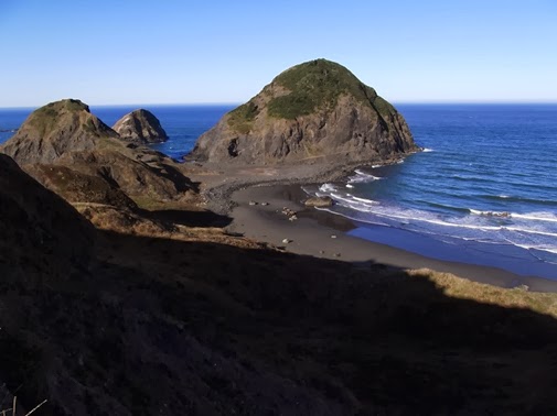
So, continuing on and driving south, we passed through Humbug Mountain State Park where we discovered some of the best scenery along the entire coast. I highly recommend stopping at Port Oxford for some outstanding panoramic views of the park looking towards the south. Although we didn’t have the time, it looks like the trek to the top of 1756-foot Humbug Mountain would be an excellent hike. The views of the rugged shoreline throughout this section of the coast are quite spectacular.


From the Boardman State Scenic Corridor we continued our southbound journey. Our final destinations of the day were the majestic redwoods in Northern California where we visited the Stout Grove at Jedediah Smith State Park, and the Lady Bird Johnson Grove in Redwood National Park.

100 Hikes/Travel Guide: Oregon Coast & Coast Range - 363 miles of cliff-edged capes, public beaches, wild rivers, sand dunes, rainforest, and coastal mountains. Many of the top attractions are within easy reach of Highway 101, but others are accessible only by trail. To help you explore both the civilized and the wild parts of Oregon's spectacular shore, this book blends two kinds of guides -- a detailed Travel Guide for touring by car and a complete Trail Guide for planning adventures on foot.
No comments:
Post a Comment
Note: Only a member of this blog may post a comment.