"The tendency nowadays to wander in wilderness is delightful to see. Thousands of tired, nerve-shaken, over-civilized people are beginning to find out that going to the mountains is going home; that wildness is a necessity; and that mountain parks and reservations are useful not only as fountains of timber and irrigating rivers, but as fountains of life."
-- John Muir
The American and Canadian west is home to thousands of miles of hiking trails. From the glacially carved mountains of the Canadian Rockies and Glacier National Park, to the red rock deserts of Sedona, hikers can find a wide range of hiking opportunities to satisfy their need for adventure, or to simply find solitude in wilderness.
Discover the West is based on many of the trails Kathy and I have hiked over the last several years. We've put this website together to help you discover some of the best hikes the western United States and the Canadian Rockies have to offer.
Here you'll find a range of hikes in Banff, Jasper, Rocky Mountain, Zion, Bryce, Arches, Grand Canyon, Guadalupe Mountains, Yellowstone, Grand Teton, Glacier, Mt. Ranier, Redwoods and Yosemite National Parks, as well as in many of the national forests, national monuments and other public lands scattered throughout the west.
* To get started, simply use the Hiking Trail Directory (organized by state) located in the upper right column
*******************************************************************************
Hikers can also visit one of our three sister websites, each of which offer comprehensive hiking trail coverage for Glacier, Grand Teton and Rocky Mountain National Parks:
* Hiking in Glacier
* Teton Hiking Trails
* Rocky Mountain Hiking Trails
*******************************************************************************
You can also purchase the mobile version of our new online trail guides for Glacier National Park and Grand Teton National Park:
Exploring Glacier National Park: The Comprehensive Hiking Guide from HikinginGlacier.com
Exploring Grand Teton National Park: The Comprehensive Hiking Guide from TetonHikingTrails.com
*******************************************************************************
The author of this website has also published the following books:
* Ramble On: A History of Hiking, which explores the rich and fascinating history of hiking.
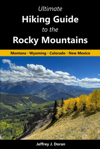
* Ultimate Hiking Guide to the Rocky Mountains: Montana, Wyoming, Colorado, New Mexico, which showcases 75 day hikes that lead to extraordinary places across the Rocky Mountain Range.
Saturday, March 28, 2026
Friday, March 27, 2026
New edition of "Ramble On: A History of Hiking" released
Virtually no one went hiking before the 19th century. What occurred that inspired ordinary people to take a walk in the woods for pleasure?
While there are enough books about mountaineering to fill a small library, very little has been written on the rich and fascinating history of hiking. Ramble On: A History of Hiking is the first book to explore how hiking evolved into one of the world’s most popular outdoor recreational activities.
Extensively researched, this book provides a broad overview of the origins of hiking, as well as the cultural trends, movements, events, and innovations that spurred its growth and allowed it to eventually flourish.
This second edition of Ramble On: A History of Hiking builds upon the original to reflect additional research and to expand more broadly on a few key topics. For example, I wanted to provide a deeper understanding of how the Age of Enlightenment and the Romantic Era influenced art, aesthetics, literature, religion and thought, which in turn allowed hiking to bloom and eventually flourish. I also thought that it was important to chronicle in more detail the crucial role the multi-generational Crawford family of New Hampshire played in the development of hiking in America. This edition also explores how the term “hiking” surprisingly evolved after the Philippine-American War to assume the meaning we understand today.
Praise for the first edition:
This second edition on the history of hiking is now available on Amazon.
While there are enough books about mountaineering to fill a small library, very little has been written on the rich and fascinating history of hiking. Ramble On: A History of Hiking is the first book to explore how hiking evolved into one of the world’s most popular outdoor recreational activities.
Extensively researched, this book provides a broad overview of the origins of hiking, as well as the cultural trends, movements, events, and innovations that spurred its growth and allowed it to eventually flourish.
This second edition of Ramble On: A History of Hiking builds upon the original to reflect additional research and to expand more broadly on a few key topics. For example, I wanted to provide a deeper understanding of how the Age of Enlightenment and the Romantic Era influenced art, aesthetics, literature, religion and thought, which in turn allowed hiking to bloom and eventually flourish. I also thought that it was important to chronicle in more detail the crucial role the multi-generational Crawford family of New Hampshire played in the development of hiking in America. This edition also explores how the term “hiking” surprisingly evolved after the Philippine-American War to assume the meaning we understand today.
Praise for the first edition:
"Doran weaves the social, cultural, industrial, and political milieu into this fascinating history. Amusing, astonishing, and sometimes alarming anecdotes .. make this a fascinating and significant account of the history of hiking."- Priscilla Estes, Appalachian Footnotes, Winter 2018-2019, Delaware Valley Chapter of the Appalachian Mountain Club
This second edition on the history of hiking is now available on Amazon.
Thursday, March 26, 2026
The Etymology of Hiking
The meaning of the word “hiking” took a rather long path for it to reach the meaning we understand today.
The following an excerpt from my new book, Ramble On: A History of Hiking:
During the last decade of John Muir’s life, the term “hiking” was just beginning to see usage as a word to describe the act of tramping through the woods. Muir, however, hated the word. Prior to the 20th century, the expression was a pejorative, or was used to describe walking in a vigorous manner, which Muir absolutely despised. To him, it meant to hurry, thus completely missing the point of immersing oneself in nature. In his book, The Mountain Trail and Its Message, published in 1911, Albert Palmer relayed a conversation he once had with Muir:
Over the years, many terms have been used to describe the act of walking in nature, such as hiking, rambling, sauntering, tramping, wandering, strolling, ambling, roaming, traipsing, marching and trekking. The first English term to describe this act was likely “rambling.” The word originally meant to wander, or roam aimlessly, but eventually evolved to describe hiking. The expression was widely used in England through the 19th century. It was also used in America for awhile, though much less frequently. While rambling is still occasionally used in the United Kingdom, it’s now mostly viewed as an old fashion term. Walking, hillwalking, fellwalking, and even hiking are more commonly used. Fellwalking, a word used to describe hiking in the mountains, comes from the English word fell or fjall, which is an Old Norse term that means mountain. In Victorian England, during the mid-1800s, wandering vagrants were derogatively known as tramps, a word that would eventually refer to hikers, and is now used by New Zealanders to describe backpacking. While tramping was widely used in America to describe hiking in the late 1800s and early 1900s, both John Muir and Henry David Thoreau were fond of using the term saunter.
Webster's Ninth New Collegiate Dictionary, published in 1985, indicates that use of the word "hike" dates back to at least 1809; however, it had a different connotation at that time. It was originally meant "to move, pull or raise with a sudden motion" or “to travel by any means.” The dictionary indicates that by 1865 the word had adopted a new meaning, which they defined as "a long walk esp. for pleasure or exercise." Etymonline.com claims that “hike” comes from the English term “hyke,” which meant "to walk vigorously." The website notes that this word also dates back to 1809. They also quote a definition of the term from the 1830 edition of the Vocabulary of East Anglia: "to go away. It is generally used in a contemptuous sense Ex. 'Come, hike,' i.e. take yourself off; begone." Slang and Its Analogues Past and Present, published in 1893, defined the oldest meaning of the word as, “To move about. Also to carry off; to arrest.” A newer definition, from 1811, was updated to mean, “To hike off; to run away.” The slang dictionary then provided an example of a more contemporary use of the term, citing a quotation from the February 2, 1884, edition of the Daily Telegraph: “We three, not having any regler [sic] homes nor a steady job of work to stick to, HIKE ABOUT for a living, and we live in the cellar of a empty house.”
It appears the meaning of the word “hike” began to evolve during the Philippine-American War. This conflict began shortly after the conclusion of the brief Spanish-American War in 1898, which involved Cuba, Puerto Rico, Guam, and the Philippines. Just weeks after the Spanish were expelled from the Philippines, fighting broke out between U.S. soldiers and Filipino nationalists. An article with the title, “The Vocabulary of the Philippines,” published in the August 19, 1899, edition of The Criterion, a weekly New York-based literary magazine, began with this highly illuminating passage:
The word “hiking” appears to have been adopted along the West Coast first, where it began to evolve into the meaning we understand today. The term and its related expressions were most likely introduced by veterans returning from the war in the Philippines. Indeed, the majority of troops returning from the Philippines passed through San Francisco, not far from the Sierra Club’s original headquarters. It’s fairly easy to speculate that the terms were likely introduced to the local population, and then members of the hiking community began borrowing them to describe the types of excursions they were taking in the nearby mountains. From the West Coast, the expressions spread across the rest of the country, which may have been the result of West Coast clubs sharing articles and correspondence with other clubs.
As the 20th century progressed, the expressions Thoreau and Muir preferred to use have mostly faded from the American lexicon. Nearly everyone in North America now uses the word “hiking.”
*******************************************************************************
Virtually no one went hiking before the 19th century. What occurred that inspired ordinary people to take a walk through the woods for pleasure? Ramble On: A History of Hiking explores the rich history of hiking, and how it evolved into one of the most popular pastimes in the world. This new edition on the history of hiking is now available on Amazon.
The following an excerpt from my new book, Ramble On: A History of Hiking:
During the last decade of John Muir’s life, the term “hiking” was just beginning to see usage as a word to describe the act of tramping through the woods. Muir, however, hated the word. Prior to the 20th century, the expression was a pejorative, or was used to describe walking in a vigorous manner, which Muir absolutely despised. To him, it meant to hurry, thus completely missing the point of immersing oneself in nature. In his book, The Mountain Trail and Its Message, published in 1911, Albert Palmer relayed a conversation he once had with Muir:
One day as I was resting in the shade Mr. Muir overtook me on the trail and began to chat in that friendly way in which he delights to talk with everyone he meets. I said to him: "Mr. Muir, someone told me you did not approve of the word 'hike.' Is that so?" His blue eyes flashed, and with his Scotch accent he replied: "I don't like either the word or the thing. People ought to saunter in the mountains - not hike!Palmer may have provided a definition of what it meant to "hike" at that point. In that same book he asserted that:
There are always some people in the mountains who are known as "hikers." They rush over the trail at high speed and take great delight in being the first to reach camp and in covering the greatest number of miles in the least possible time. They measure the trail in terms of speed and distance.Perhaps that was an accurate description. On the other hand, it’s possible he may have conveyed a meaning that was already in the process of becoming outdated.
Over the years, many terms have been used to describe the act of walking in nature, such as hiking, rambling, sauntering, tramping, wandering, strolling, ambling, roaming, traipsing, marching and trekking. The first English term to describe this act was likely “rambling.” The word originally meant to wander, or roam aimlessly, but eventually evolved to describe hiking. The expression was widely used in England through the 19th century. It was also used in America for awhile, though much less frequently. While rambling is still occasionally used in the United Kingdom, it’s now mostly viewed as an old fashion term. Walking, hillwalking, fellwalking, and even hiking are more commonly used. Fellwalking, a word used to describe hiking in the mountains, comes from the English word fell or fjall, which is an Old Norse term that means mountain. In Victorian England, during the mid-1800s, wandering vagrants were derogatively known as tramps, a word that would eventually refer to hikers, and is now used by New Zealanders to describe backpacking. While tramping was widely used in America to describe hiking in the late 1800s and early 1900s, both John Muir and Henry David Thoreau were fond of using the term saunter.
Webster's Ninth New Collegiate Dictionary, published in 1985, indicates that use of the word "hike" dates back to at least 1809; however, it had a different connotation at that time. It was originally meant "to move, pull or raise with a sudden motion" or “to travel by any means.” The dictionary indicates that by 1865 the word had adopted a new meaning, which they defined as "a long walk esp. for pleasure or exercise." Etymonline.com claims that “hike” comes from the English term “hyke,” which meant "to walk vigorously." The website notes that this word also dates back to 1809. They also quote a definition of the term from the 1830 edition of the Vocabulary of East Anglia: "to go away. It is generally used in a contemptuous sense Ex. 'Come, hike,' i.e. take yourself off; begone." Slang and Its Analogues Past and Present, published in 1893, defined the oldest meaning of the word as, “To move about. Also to carry off; to arrest.” A newer definition, from 1811, was updated to mean, “To hike off; to run away.” The slang dictionary then provided an example of a more contemporary use of the term, citing a quotation from the February 2, 1884, edition of the Daily Telegraph: “We three, not having any regler [sic] homes nor a steady job of work to stick to, HIKE ABOUT for a living, and we live in the cellar of a empty house.”
It appears the meaning of the word “hike” began to evolve during the Philippine-American War. This conflict began shortly after the conclusion of the brief Spanish-American War in 1898, which involved Cuba, Puerto Rico, Guam, and the Philippines. Just weeks after the Spanish were expelled from the Philippines, fighting broke out between U.S. soldiers and Filipino nationalists. An article with the title, “The Vocabulary of the Philippines,” published in the August 19, 1899, edition of The Criterion, a weekly New York-based literary magazine, began with this highly illuminating passage:
Now that the volunteers are returning from the Philippines there is trouble ahead for the dictionary makers. It is a peculiarity of American slang that it is at once so concise, picturesque, and graphic that most new words of this kind eventually force their way, despite dissent, into the lexicon. The volunteers will bring back with them so many brand new expressions of this character that their vocabulary may prove all but incomprehensible. For the convenience of people who have not had the advantage of recent Philippine travel, and also for the future reference of our lexicographers, a short glossary, with comments, may be valuable.A review of several military-related publications from this era corroborates these definitions. Moreover, a comment in the March 2, 1901, edition of the Army and Navy Journal confirms that the terms were new to the broader civilian population in America: “Some time ago we referred to ‘hike’ and other expressive words which our boys in the field have added to our vocabulary.” It appears that soldiers used the term “hiking” to distinguish their mode of travel in this foreign land from traditional marching. As the fighting escalated, the Filipinos began engaging U.S. troops in guerrilla-style warfare. As a result, U.S. soldiers were often forced to bushwhack through dense jungles, grasslands, swamps and rice paddy fields. There are also several references to “hiking” along rugged mountain trails. What’s important to note is that both “hike” and “hiking” were scarcely used before the war, but quickly became part of the American lexicon in the years that immediately followed. Within a decade or so, the terms basically took on the meaning that we understand today. You can see how the definition evolved over a very short period of time. The 1903 edition of Supplement To A Standard Dictionary Of The English Language defined “Hike” as “The act of hiking; a weary journey on foot.” The 1911 edition of Webster’s New International Dictionary defined “hike” as the “Act of hiking; a tramp; march.” More importantly, within a few years of the conclusion of the war, references to hiking began to appear in several outdoor publications for the first time. The words “hike” and “hiker” were first used in the Sierra Bulletin, the journal of the Sierra Club, in 1905. The following passage from this edition obviously reflects the sentiment of John Muir:
One of the words most commonly used in this new dialect is “hike.” Its derivation is doubtful, but its descriptive power great and swift. “To hike” means to travel with amazing speed. It is generally used to give some idea of how fast the Filipinos can run when defeated in battle. Incidentally, “hiking” is a term applied to the speed which American soldiers are obliged to develop when trying to catch the fleeing Filipino. So, in a more general way, “hiking” is applied to any swift and fatiguing travel, while a “hiker” is obviously a man of hustling and enduring powers.
There is the aristocrat of leg and lung, the “hiker,” so called, who walks up perpendicular cliffs like a fly, never misses the trail, and always reaches camp first. He is harmless, but is not generally loved, for he is a little overbearing and given to much talking of a certain catalogue of hours and distances which he keeps in his mind and calls his record.We see additional uses of the three hiking-related expressions in subsequent issues of the Sierra Bulletin. Other examples of early usage of the terms include an article about “A Sierra Club Hike” in the August 6, 1909, edition of The California Weekly. One of the earliest uses of the phrase “hiking boots” appeared in an advertisement in the 1912 edition of The Mountaineer, the journal of The Mountaineers club out of Seattle. The October 1911 edition of The American Boy, the October 1912 edition of Boys Life, and The Boy Scout’s Hike Book from 1913 are all sprinkled with several references to hiking. Prior to 1910, most hiking clubs used the word "mountain" or "alpine" in their name. However, in that year, the Wanderlusters Hiking Club out of Washington D.C. became the first organization to use "hiking" in a club name.
The word “hiking” appears to have been adopted along the West Coast first, where it began to evolve into the meaning we understand today. The term and its related expressions were most likely introduced by veterans returning from the war in the Philippines. Indeed, the majority of troops returning from the Philippines passed through San Francisco, not far from the Sierra Club’s original headquarters. It’s fairly easy to speculate that the terms were likely introduced to the local population, and then members of the hiking community began borrowing them to describe the types of excursions they were taking in the nearby mountains. From the West Coast, the expressions spread across the rest of the country, which may have been the result of West Coast clubs sharing articles and correspondence with other clubs.
As the 20th century progressed, the expressions Thoreau and Muir preferred to use have mostly faded from the American lexicon. Nearly everyone in North America now uses the word “hiking.”
*******************************************************************************
Virtually no one went hiking before the 19th century. What occurred that inspired ordinary people to take a walk through the woods for pleasure? Ramble On: A History of Hiking explores the rich history of hiking, and how it evolved into one of the most popular pastimes in the world. This new edition on the history of hiking is now available on Amazon.
Wednesday, March 25, 2026
Why did hiking become so popular across the globe?
The following is an adaptation from Ramble On: A History of Hiking:
Since the dawn of mankind, humans have walked the planet to hunt, forage, explore, trade goods with neighboring communities, and migrate to other regions. At some point in our long evolution, we realized we didn’t need a utilitarian reason to walk. Somewhere along the line we discovered the joy of traipsing through the countryside, observing the beauty of a wildflower, watching wildlife in their natural habitat, marveling at the roar of a waterfall, or contemplating the scenic grandeur from the top of a mountain. Is this a fairly recent phenomenon, or is this an innate characteristic of human beings?
While history has preserved a few examples of men scaling mountains for an assortment of reasons prior to the early modern era, these feats appear to be extremely rare. Before the fifteenth and sixteenth centuries, mountains were commonly seen as dangerous and mysterious by most Western cultures, at least according to prevailing wisdom. People from the Middle Ages purportedly regarded them with fear, loathing and superstition. Moreover, they thought the alpine world was inhabited by evil spirits, witches, wild beasts and bandits. Some men even swore affidavits before magistrates that they had seen dragons in the mountains.
However, as the Renaissance and Enlightenment periods progressed and spread across Europe, fear of mountains slowly began to subside, and more men began venturing into the highlands. Several modern historians contend that attitudes towards mountains started to shift as a result of the religious and philosophical tenets of natural theology, which proposed that God is revealed through reason and nature, rather than sacred texts, divine revelation or supernatural beliefs. They argue that individuals from this era began to realize that fear and loathing of mountains wasn’t justified. The perception that they were inherently dark and evil inevitably changed after it was understood that it was God who had created them. Consequently, people started viewing mountains as images of the Creator, as sources of spiritual inspiration, or even as proof of God’s existence. Leslie Stephen, on the other hand, claimed that attitudes simply evolved in conjunction with the revolution in ideas and thinking that occurred during the Age of Enlightenment. As one of the most famous British climbers from the “Golden Age of Alpinism,” Stephen argued in 1868 that "The history of mountaineering is, to a great extent, the history of the process by which men have gradually conquered the phantoms of their own imagination."
By the mid-1700s, we begin to see the first documented rambling and walking excursions. While the historical record seemingly indicates that mountaineering preceded hiking by several decades, or even centuries, it doesn’t necessarily mean that people didn’t hike or walk for recreational purposes prior to this timeframe. Rather, it seems more likely that those who did set out on foot never would’ve considered a leisurely walk in the countryside to be a noteworthy event. Therefore, very few individuals would’ve taken the time to record their rambles for posterity, even if they were literate. As a result, hiking doesn’t have a date of birth, or even an approximated timeframe for its origins. It seems most likely that walking for pleasure has always been a natural form of recreation that evolved over time to a point where individuals began to take it more seriously, whereupon we begin to see the first descriptions of walking excursions in diaries, letters, poems and travelogues.
The roots of hiking and walking for pleasure were firmly established by the late 1700s, especially in Great Britain and certain parts of Europe. However, during the earlier part of the century, walking was generally looked down upon. “Respectable” citizens during this era usually rode in carriages or on horseback to travel any significant distances. For the most part only the poor walked. In Victorian England, during the mid-1800s, wandering vagrants were derogatively known as tramps, a word that would eventually refer to hikers, and now used by New Zealanders to describe backpacking.
While overcoming the fear of mountains, and the gradual breakdown in the social stigmas associated with walking certainly enabled mountaineering and hiking to germinate, I would argue that the single most important event to spur the development of hiking and walking for pleasure was the Industrial Revolution. The social changes brought about by industrialization were profound. As I explain in more detail in my book, industrialization triggered a massive backlash from certain segments of society, which inspired movements in art, philosophy and religion. These movements, in turn, would motivate people in one way or another to visit wilderness areas for recreational purposes. As industrialization progressed, especially in America, it gave rise to the labor movement, which eventually resulted in increased wages, and significant reductions in the number of hours worked each week. Thus, workers began to enjoy more free time, many of whom pursued recreation in the great outdoors. Industrialization also gave rise to railroads, automobiles and roads, which provided people with the ability to travel more easily to wilderness areas. As a result of these social transformations and movements, hiking emerged as a pastime. Though it was just a fringe activity in the early 1800s, the sport grew steadily through the Great Depression. After World War II, however, it exploded, and has now become one of the world's most popular outdoor activities.
You can learn more about the history of hiking on my author page.
Other excerpts from Ramble On:
* The Etymology of Hiking
* The Historic Circle Tours of Glacier National Park
* Women’s Hiking Attire During The Victorian Era
* The Evolution of Hiking Boots
*******************************************************************************
Virtually no one went hiking before the 19th century. What occurred that inspired ordinary people to take a walk through the woods for pleasure? Ramble On: A History of Hiking explores the rich history of hiking, and how it evolved into one of the most popular pastimes in the world.
Since the dawn of mankind, humans have walked the planet to hunt, forage, explore, trade goods with neighboring communities, and migrate to other regions. At some point in our long evolution, we realized we didn’t need a utilitarian reason to walk. Somewhere along the line we discovered the joy of traipsing through the countryside, observing the beauty of a wildflower, watching wildlife in their natural habitat, marveling at the roar of a waterfall, or contemplating the scenic grandeur from the top of a mountain. Is this a fairly recent phenomenon, or is this an innate characteristic of human beings?
While history has preserved a few examples of men scaling mountains for an assortment of reasons prior to the early modern era, these feats appear to be extremely rare. Before the fifteenth and sixteenth centuries, mountains were commonly seen as dangerous and mysterious by most Western cultures, at least according to prevailing wisdom. People from the Middle Ages purportedly regarded them with fear, loathing and superstition. Moreover, they thought the alpine world was inhabited by evil spirits, witches, wild beasts and bandits. Some men even swore affidavits before magistrates that they had seen dragons in the mountains.
However, as the Renaissance and Enlightenment periods progressed and spread across Europe, fear of mountains slowly began to subside, and more men began venturing into the highlands. Several modern historians contend that attitudes towards mountains started to shift as a result of the religious and philosophical tenets of natural theology, which proposed that God is revealed through reason and nature, rather than sacred texts, divine revelation or supernatural beliefs. They argue that individuals from this era began to realize that fear and loathing of mountains wasn’t justified. The perception that they were inherently dark and evil inevitably changed after it was understood that it was God who had created them. Consequently, people started viewing mountains as images of the Creator, as sources of spiritual inspiration, or even as proof of God’s existence. Leslie Stephen, on the other hand, claimed that attitudes simply evolved in conjunction with the revolution in ideas and thinking that occurred during the Age of Enlightenment. As one of the most famous British climbers from the “Golden Age of Alpinism,” Stephen argued in 1868 that "The history of mountaineering is, to a great extent, the history of the process by which men have gradually conquered the phantoms of their own imagination."
By the mid-1700s, we begin to see the first documented rambling and walking excursions. While the historical record seemingly indicates that mountaineering preceded hiking by several decades, or even centuries, it doesn’t necessarily mean that people didn’t hike or walk for recreational purposes prior to this timeframe. Rather, it seems more likely that those who did set out on foot never would’ve considered a leisurely walk in the countryside to be a noteworthy event. Therefore, very few individuals would’ve taken the time to record their rambles for posterity, even if they were literate. As a result, hiking doesn’t have a date of birth, or even an approximated timeframe for its origins. It seems most likely that walking for pleasure has always been a natural form of recreation that evolved over time to a point where individuals began to take it more seriously, whereupon we begin to see the first descriptions of walking excursions in diaries, letters, poems and travelogues.
The roots of hiking and walking for pleasure were firmly established by the late 1700s, especially in Great Britain and certain parts of Europe. However, during the earlier part of the century, walking was generally looked down upon. “Respectable” citizens during this era usually rode in carriages or on horseback to travel any significant distances. For the most part only the poor walked. In Victorian England, during the mid-1800s, wandering vagrants were derogatively known as tramps, a word that would eventually refer to hikers, and now used by New Zealanders to describe backpacking.
While overcoming the fear of mountains, and the gradual breakdown in the social stigmas associated with walking certainly enabled mountaineering and hiking to germinate, I would argue that the single most important event to spur the development of hiking and walking for pleasure was the Industrial Revolution. The social changes brought about by industrialization were profound. As I explain in more detail in my book, industrialization triggered a massive backlash from certain segments of society, which inspired movements in art, philosophy and religion. These movements, in turn, would motivate people in one way or another to visit wilderness areas for recreational purposes. As industrialization progressed, especially in America, it gave rise to the labor movement, which eventually resulted in increased wages, and significant reductions in the number of hours worked each week. Thus, workers began to enjoy more free time, many of whom pursued recreation in the great outdoors. Industrialization also gave rise to railroads, automobiles and roads, which provided people with the ability to travel more easily to wilderness areas. As a result of these social transformations and movements, hiking emerged as a pastime. Though it was just a fringe activity in the early 1800s, the sport grew steadily through the Great Depression. After World War II, however, it exploded, and has now become one of the world's most popular outdoor activities.
You can learn more about the history of hiking on my author page.
Other excerpts from Ramble On:
* The Etymology of Hiking
* The Historic Circle Tours of Glacier National Park
* Women’s Hiking Attire During The Victorian Era
* The Evolution of Hiking Boots
*******************************************************************************
Virtually no one went hiking before the 19th century. What occurred that inspired ordinary people to take a walk through the woods for pleasure? Ramble On: A History of Hiking explores the rich history of hiking, and how it evolved into one of the most popular pastimes in the world.
Tuesday, March 24, 2026
The Historic Circle Tours of Glacier National Park
The following is an adaptation from my book, Ramble On: A History of Hiking:
Almost immediately after Glacier was established as a national park, Louis W. Hill, president of the Great Northern Railway, began building a series of hotels, chalets and tent camps throughout the park. The buildings were modeled on traditional Swiss architecture, and were part of Hill's strategy to portray Glacier as the "American Alps" or "America's Switzerland." The accommodations would in-turn help the railway promote tourism to the new national park, while at the same time promote their rail line as the primary mode of travel to the park. This would also allow them to compete against their chief rivals; the Canadian Pacific Railway and the Northern Pacific Railway, who were already transporting tourists to Banff and Yellowstone.
The Belton Chalet in West Glacier, and the Glacier Park Lodge in East Glacier Park were the first two hotels to be constructed by Great Northern. Both acted as gateways from railroad depots to the interior of the park. Between 1910 and 1915, the railway also constructed eight Swiss-style backcountry chalet complexes, each connected by a network of trails. The complexes were strategically located at Two Medicine Lake, Cut Bank, St. Mary, Sun Point, Granite Park, Many Glacier, Gunsight Lake and Sperry Glacier. Tent camps were also established at Red Eagle Lake, Cosley Lake, Fifty Mountain and Goat Haunt. The chalet and tent camps were located roughly 10-18 miles apart. During their prime most of the chalet camps could host between 100 and 150 guests per night. Hill would explain to newspaper reporters that the “lodges would be located only far enough apart so that the man on foot even could make the trip and obtain sleeping accommodations,” and that “hotel accommodations of a more prestigious type or tents for the most modest could also be furnished.”
As construction on the new chalets progressed through the early 1910s, the railway also constructed the trails that would connect each of them by foot or horse travel. Because of a lack of federal funds, the Great Northern Railway assumed financial responsibility for all trail construction during this time period, but was eventually reimbursed as funding became available. Some of the earliest trails developed by the railway included Swiftcurrent Pass, Gunsight Pass, Mt. Henry, Red Gap Pass, Gable Pass, Triple Divide Pass, Piegan Pass, Pitamakan Pass and the St. Mary Lake trails. Many of these early trails were routed along Indian paths, prospector trails or old game trails. Great Northern would continue to improve or construct new trails within the park into the early 1920s. As the network of trails expanded, organized tours by horse concessionaires began to emerge. In 1915, the Park Saddle Horse Company became the sole concessionaire for the park, and began organizing a series of guided tours that utilized the existing network of chalets and trails. This included the North Circle, South Circle and Inside Trail trips, which encompassed roughly 163 miles of trails, each of which is now on the National Register of Historic Places. The company also offered the Logan Pass Triangle Trail trip, which traversed across the heart of the park utilizing routes from the other tours, as well as the now abandoned Logan Pass Trail, which I discussed in detail yesterday. The concessionaire offered a variety of options, from half-day excursions to extended trips lasting up to two weeks. Most of the so-called circle tours, however, lasted between three and five days. During the 1920 season, the company charged roughly $4.00 per person, per day to take one of its saddle-horse tours.
Although there were several variations of each of these trips, depending on the number of days tourists chose, the direction they wanted to take, as well as the evolution of routes over time, these are the routes described on the National Register of Historic Places Registration Form and various park brochures:
The North Circle: Connects Many Glacier with Cosley (aka Crossley) Lake; Cosley Lake with Goathaunt; Goathaunt with Fifty Mountain; Fifty Mountain with Granite Park; Granite Park with Many Glacier.
The South Circle: Connects Lake McDonald Lodge with Sperry Chalets; Sperry Chalets with Sun Point via Gunsight Pass; Sun Point with Many Glacier via Piegan Pass; Many Glacier with Granite Park via Swiftcurrent Pass; Granite Park with Going-to-the-Sun Road at Packer's Roost.
Logan Pass Triangle trip: Three-day trip made as follows: Many Glacier Hotel to Granite Park Chalets via Swiftcurrent Pass, thence along the west side of the Garden Wall through Logan Pass to Going-to-the-Sun Chalets, thence back to Many Glacier Hotel via Glacial Meadows and Piegan Pass. Rate for guide and horses, $12.50 per person. Going-to-the-Sun Chalets is also a point of departure for this trip.
Inside Trail: Guide and horses may be obtained for a five-day trip over the inside trail from Glacier Park Hotel, via Two Medicine Chalets, thence via Mount Morgan Pass (now known as Pitamakan Pass) to Cut Bank Chalets, thence via Triple Divide, Red Eagle Lake, to St. Mary Chalets, thence via boat across St. Mary Lake to Going-to-the-Sun Chalets, thence via Piegan Pass to Many Glacier Hotel, at the rate of $18 for each person, including boat fare, if five or more make the trip. This trip may be made in either direction.
The park visitors that took these tours were “guided by ‘cowboys,’ lunched near glacial lakes and then dined in comfort on Chinese linen and blue willow china”. Park rules dictated that the Park Saddle Horse Company had to furnish at least one guide for each ten tourists on a trip. Parties could reach as large as 180 people and 200 horses. It’s estimated that the concessionaire used more than 1000 horses during its peak, with at least one source estimating as many as 1500 head of horses. The 1922 park brochure bragged that there were "more saddle horses used in Glacier than in any other similar recreational area in the world". From everything I’ve read that record has never been surpassed.
The saddle-horse tours were the dominant method of seeing the park until the Going-to-the-Sun Road was completed in 1933. Although the tours continued for another ten seasons, they came to a permanent end after the 1942 season when America became fully involved in World War II.
Ramble On chronicles the history of the first hikers, trails, and hiking clubs, as well as the evolution of hiking gear and apparel. This broad-based book on hiking history is available on Amazon.
Other excerpts from Ramble On: A History of Hiking:
* The Etymology of Hiking
* How did hiking become so popular across the globe?
* Women’s Hiking Attire During The Victorian Era
* The Evolution of Hiking Boots
*******************************************************************************
Glacier National Park preserves more than a million acres of some of the most spectacular scenery on Earth. With more than 740 miles of trails meandering throughout this vast park, how will you find and choose the most scenic and rewarding hikes?
Exploring Glacier National Park takes all the guesswork out by focusing on the most amazing hikes, and provides you with handpicked recommendations that will allow you to make the most of your trip to Glacier:
Almost immediately after Glacier was established as a national park, Louis W. Hill, president of the Great Northern Railway, began building a series of hotels, chalets and tent camps throughout the park. The buildings were modeled on traditional Swiss architecture, and were part of Hill's strategy to portray Glacier as the "American Alps" or "America's Switzerland." The accommodations would in-turn help the railway promote tourism to the new national park, while at the same time promote their rail line as the primary mode of travel to the park. This would also allow them to compete against their chief rivals; the Canadian Pacific Railway and the Northern Pacific Railway, who were already transporting tourists to Banff and Yellowstone.
The Belton Chalet in West Glacier, and the Glacier Park Lodge in East Glacier Park were the first two hotels to be constructed by Great Northern. Both acted as gateways from railroad depots to the interior of the park. Between 1910 and 1915, the railway also constructed eight Swiss-style backcountry chalet complexes, each connected by a network of trails. The complexes were strategically located at Two Medicine Lake, Cut Bank, St. Mary, Sun Point, Granite Park, Many Glacier, Gunsight Lake and Sperry Glacier. Tent camps were also established at Red Eagle Lake, Cosley Lake, Fifty Mountain and Goat Haunt. The chalet and tent camps were located roughly 10-18 miles apart. During their prime most of the chalet camps could host between 100 and 150 guests per night. Hill would explain to newspaper reporters that the “lodges would be located only far enough apart so that the man on foot even could make the trip and obtain sleeping accommodations,” and that “hotel accommodations of a more prestigious type or tents for the most modest could also be furnished.”
As construction on the new chalets progressed through the early 1910s, the railway also constructed the trails that would connect each of them by foot or horse travel. Because of a lack of federal funds, the Great Northern Railway assumed financial responsibility for all trail construction during this time period, but was eventually reimbursed as funding became available. Some of the earliest trails developed by the railway included Swiftcurrent Pass, Gunsight Pass, Mt. Henry, Red Gap Pass, Gable Pass, Triple Divide Pass, Piegan Pass, Pitamakan Pass and the St. Mary Lake trails. Many of these early trails were routed along Indian paths, prospector trails or old game trails. Great Northern would continue to improve or construct new trails within the park into the early 1920s. As the network of trails expanded, organized tours by horse concessionaires began to emerge. In 1915, the Park Saddle Horse Company became the sole concessionaire for the park, and began organizing a series of guided tours that utilized the existing network of chalets and trails. This included the North Circle, South Circle and Inside Trail trips, which encompassed roughly 163 miles of trails, each of which is now on the National Register of Historic Places. The company also offered the Logan Pass Triangle Trail trip, which traversed across the heart of the park utilizing routes from the other tours, as well as the now abandoned Logan Pass Trail, which I discussed in detail yesterday. The concessionaire offered a variety of options, from half-day excursions to extended trips lasting up to two weeks. Most of the so-called circle tours, however, lasted between three and five days. During the 1920 season, the company charged roughly $4.00 per person, per day to take one of its saddle-horse tours.
Although there were several variations of each of these trips, depending on the number of days tourists chose, the direction they wanted to take, as well as the evolution of routes over time, these are the routes described on the National Register of Historic Places Registration Form and various park brochures:
The North Circle: Connects Many Glacier with Cosley (aka Crossley) Lake; Cosley Lake with Goathaunt; Goathaunt with Fifty Mountain; Fifty Mountain with Granite Park; Granite Park with Many Glacier.
The South Circle: Connects Lake McDonald Lodge with Sperry Chalets; Sperry Chalets with Sun Point via Gunsight Pass; Sun Point with Many Glacier via Piegan Pass; Many Glacier with Granite Park via Swiftcurrent Pass; Granite Park with Going-to-the-Sun Road at Packer's Roost.
Logan Pass Triangle trip: Three-day trip made as follows: Many Glacier Hotel to Granite Park Chalets via Swiftcurrent Pass, thence along the west side of the Garden Wall through Logan Pass to Going-to-the-Sun Chalets, thence back to Many Glacier Hotel via Glacial Meadows and Piegan Pass. Rate for guide and horses, $12.50 per person. Going-to-the-Sun Chalets is also a point of departure for this trip.
Inside Trail: Guide and horses may be obtained for a five-day trip over the inside trail from Glacier Park Hotel, via Two Medicine Chalets, thence via Mount Morgan Pass (now known as Pitamakan Pass) to Cut Bank Chalets, thence via Triple Divide, Red Eagle Lake, to St. Mary Chalets, thence via boat across St. Mary Lake to Going-to-the-Sun Chalets, thence via Piegan Pass to Many Glacier Hotel, at the rate of $18 for each person, including boat fare, if five or more make the trip. This trip may be made in either direction.
The park visitors that took these tours were “guided by ‘cowboys,’ lunched near glacial lakes and then dined in comfort on Chinese linen and blue willow china”. Park rules dictated that the Park Saddle Horse Company had to furnish at least one guide for each ten tourists on a trip. Parties could reach as large as 180 people and 200 horses. It’s estimated that the concessionaire used more than 1000 horses during its peak, with at least one source estimating as many as 1500 head of horses. The 1922 park brochure bragged that there were "more saddle horses used in Glacier than in any other similar recreational area in the world". From everything I’ve read that record has never been surpassed.
The saddle-horse tours were the dominant method of seeing the park until the Going-to-the-Sun Road was completed in 1933. Although the tours continued for another ten seasons, they came to a permanent end after the 1942 season when America became fully involved in World War II.
Ramble On chronicles the history of the first hikers, trails, and hiking clubs, as well as the evolution of hiking gear and apparel. This broad-based book on hiking history is available on Amazon.
Other excerpts from Ramble On: A History of Hiking:
* The Etymology of Hiking
* How did hiking become so popular across the globe?
* Women’s Hiking Attire During The Victorian Era
* The Evolution of Hiking Boots
*******************************************************************************
Glacier National Park preserves more than a million acres of some of the most spectacular scenery on Earth. With more than 740 miles of trails meandering throughout this vast park, how will you find and choose the most scenic and rewarding hikes?
Exploring Glacier National Park takes all the guesswork out by focusing on the most amazing hikes, and provides you with handpicked recommendations that will allow you to make the most of your trip to Glacier:
Sunday, March 15, 2026
The Evolution of Hiking Boots
The following is an adaptation from my new book, Ramble On: A History of Hiking:
Prior to the 1970s and 80s, most hikers wore hunting, riding, military or everyday work boots while hiking. Some even wore gym shoes. Grandma Gatewood famously wore Keds sneakers during her first thru-hike of the Appalachian Trail in 1955. While so-called “mountain boots” were also available as early as the 1850s, they were mostly worn by climbers and adventurers from the upper classes who could afford their high price tags. One of the earliest uses of the phrase “hiking boots” appeared in an advertisement in the 1912 edition of The Mountaineer, the journal of The Mountaineers club out of Seattle. The use of this phrase in this instance, however, likely referred to “mountain boots”.
The first major improvement in mountaineering boots came about as a result of a deadly climbing accident in 1935. While descending Punta Rasica, a rugged peak along the Swiss-Italian border, an expedition led by Vitale Bramani was caught in an unexpected blizzard. Unable to descend along the icy rock walls, six members of his party ultimately succumbed to exhaustion, exposure and frostbite. As was the custom at that time, climbers wore heavy, hobnailed boots along the lower slopes of mountains. As they climbed higher, they would exchange their boots for lighter rock climbing shoes, usually made with thin leather and felt-bottom soles that offered little protection against cold temperatures or moisture. Though they worked well in normal weather, the shoes offered virtually no grip in icy conditions. Convinced that inadequate footwear played the primary role in the deaths of his six companions, Bramani resolved to find a solution to the problem. Two years later he introduced a boot sole with an innovative tread design that he called Carrarmato, which means “tank tread.” The sole was made from vulcanized rubber, and featured heavy lugs that were designed to take the place of hobnails. The rubber lug pattern provided boots with outstanding traction, which allowed them to be used on a variety of surfaces, including uneven forest floors, bare rock, loose scree slopes, and hard-packed snow. Moreover, the rubber soles were highly durable, abrasion-resistant, waterproof, and provided far more insulation against the cold than leather soles. In 1937, with the financial backing of Leopoldo Pirelli, grandson of the founder of Pirelli Tires, Bramani launched his revolutionary new product. Taking the first two letters of his first name, and the first four letters of his last name, Vitale Bramani called his startup enterprise “Vibram.” Almost immediately, the lugged soles caught on with the climbing community, and eventually with hikers in the 1960s and 70s.
By the 1970s, American bootmakers were beginning to turn their attention towards the production of lighter boots for day hikers and backpackers. One of the first boots to deliver on this promise was the Danner 6490, which weighed in at just 3 pounds and 14 ounces. In its Winter 1973 edition, Backpacker Magazine declared that the 6490 was very close to being their “ideal hiking shoe.” Since the introduction of that boot, manufacturers have made numerous advances over the years that have reduced the overall weight of hiking boots. This includes the use of lightweight leather or synthetic fabric uppers, replacing stitching with cement or injection molding to attach uppers to soles, and the use of shallower lugs.
The next major technological advance in boots came in 1980 when both Danner and Donner Mountain Corporation introduced the first hiking boots made with Gore-Tex. The introduction of Gore-Tex resulted in boots that were lighter, breathable, more durable, nearly waterproof, and far more flexible, all of which resulted in increased comfort. Once the original high production costs were slashed, the use of Gore-Tex in hiking boots became the industry standard. Nearly all quality hiking boots sold today are made with Gore-Tex or some other waterproof-breathable fabric.
This new, improved and expanded edition on the history of hiking is available on Amazon.
Other excerpts from Ramble On:
* Women’s Hiking Attire During The Victorian Era
* How did hiking become so popular across the globe?
* The Historic Circle Tours of Glacier National Park
*******************************************************************************
Virtually no one went hiking before the 19th century. What occurred that inspired ordinary people to take a walk through the woods for pleasure? Ramble On: A History of Hiking explores the rich history of hiking, and how it evolved into one of the most popular pastimes in the world.
Prior to the 1970s and 80s, most hikers wore hunting, riding, military or everyday work boots while hiking. Some even wore gym shoes. Grandma Gatewood famously wore Keds sneakers during her first thru-hike of the Appalachian Trail in 1955. While so-called “mountain boots” were also available as early as the 1850s, they were mostly worn by climbers and adventurers from the upper classes who could afford their high price tags. One of the earliest uses of the phrase “hiking boots” appeared in an advertisement in the 1912 edition of The Mountaineer, the journal of The Mountaineers club out of Seattle. The use of this phrase in this instance, however, likely referred to “mountain boots”.
The first major improvement in mountaineering boots came about as a result of a deadly climbing accident in 1935. While descending Punta Rasica, a rugged peak along the Swiss-Italian border, an expedition led by Vitale Bramani was caught in an unexpected blizzard. Unable to descend along the icy rock walls, six members of his party ultimately succumbed to exhaustion, exposure and frostbite. As was the custom at that time, climbers wore heavy, hobnailed boots along the lower slopes of mountains. As they climbed higher, they would exchange their boots for lighter rock climbing shoes, usually made with thin leather and felt-bottom soles that offered little protection against cold temperatures or moisture. Though they worked well in normal weather, the shoes offered virtually no grip in icy conditions. Convinced that inadequate footwear played the primary role in the deaths of his six companions, Bramani resolved to find a solution to the problem. Two years later he introduced a boot sole with an innovative tread design that he called Carrarmato, which means “tank tread.” The sole was made from vulcanized rubber, and featured heavy lugs that were designed to take the place of hobnails. The rubber lug pattern provided boots with outstanding traction, which allowed them to be used on a variety of surfaces, including uneven forest floors, bare rock, loose scree slopes, and hard-packed snow. Moreover, the rubber soles were highly durable, abrasion-resistant, waterproof, and provided far more insulation against the cold than leather soles. In 1937, with the financial backing of Leopoldo Pirelli, grandson of the founder of Pirelli Tires, Bramani launched his revolutionary new product. Taking the first two letters of his first name, and the first four letters of his last name, Vitale Bramani called his startup enterprise “Vibram.” Almost immediately, the lugged soles caught on with the climbing community, and eventually with hikers in the 1960s and 70s.
By the 1970s, American bootmakers were beginning to turn their attention towards the production of lighter boots for day hikers and backpackers. One of the first boots to deliver on this promise was the Danner 6490, which weighed in at just 3 pounds and 14 ounces. In its Winter 1973 edition, Backpacker Magazine declared that the 6490 was very close to being their “ideal hiking shoe.” Since the introduction of that boot, manufacturers have made numerous advances over the years that have reduced the overall weight of hiking boots. This includes the use of lightweight leather or synthetic fabric uppers, replacing stitching with cement or injection molding to attach uppers to soles, and the use of shallower lugs.
The next major technological advance in boots came in 1980 when both Danner and Donner Mountain Corporation introduced the first hiking boots made with Gore-Tex. The introduction of Gore-Tex resulted in boots that were lighter, breathable, more durable, nearly waterproof, and far more flexible, all of which resulted in increased comfort. Once the original high production costs were slashed, the use of Gore-Tex in hiking boots became the industry standard. Nearly all quality hiking boots sold today are made with Gore-Tex or some other waterproof-breathable fabric.
This new, improved and expanded edition on the history of hiking is available on Amazon.
Other excerpts from Ramble On:
* Women’s Hiking Attire During The Victorian Era
* How did hiking become so popular across the globe?
* The Historic Circle Tours of Glacier National Park
*******************************************************************************
Virtually no one went hiking before the 19th century. What occurred that inspired ordinary people to take a walk through the woods for pleasure? Ramble On: A History of Hiking explores the rich history of hiking, and how it evolved into one of the most popular pastimes in the world.
Tuesday, March 10, 2026
The Etymology of Hiking
Did you know the word “hiking” derived its meaning as we know it today as a result of the Philippine-American War:
You can read more about the history of hiking in Ramble On: A History of Hiking.
************************************************************************************
Check out our online trail guides:
You can read more about the history of hiking in Ramble On: A History of Hiking.
************************************************************************************
Check out our online trail guides:
- Glacier National Park: HikinginGlacier.com
- Grand Teton National Park: TetonHikingTrails.com
- Rocky Mountain National Park: RockyMountainHikingTrails.com
- My new, improved and expanded edition on the history of hiking is now available on Amazon
Sunday, March 8, 2026
The True Realities of Women’s Hiking Attire During The Victorian Era
The following is an excerpt from my new book, Ramble On: A History of Hiking.
During the Victorian Era, women's hiking attire was an extremely complicated affair. The subject was frequently discussed and debated throughout the pages of Appalachia during the Appalachian Mountain Club’s first decade or so. The December 1887 issue of the journal ran a lengthy article by Mrs. L. D. Pychowska on the “walking-costume for ladies.” It provided head-to-toe advice on how women should dress for a hike. This included wearing grey flannel trousers beneath two skirts. The underskirt, which reached to just below the knee, was also to be made of grey flannel. The outer skirt, however, was to be made of winsey or Kentucky jean, both of which were considered to be strong enough to resist tearing while walking through briars and undergrowth. The outer skirt was also meant to be worn to ankle length. However, if the hiker was traversing along steep terrain, she could simply pull out a strong clasp pin and raise the skirt higher, “washwomen fashion,” until the difficult section was completed. “Basquines,” or corsets, were optional apparel according to the author. At the end of the detailed piece, the writer assured club members that her recommendations on female attire would be “sufficiently presentable to enter a hotel or a railroad car” after a long tramp “without attracting uncomfortable attention.”
The practicalities of wearing a “costume” such as this, however, weren’t considered or debated in Mrs. Pychowska’s article. Conversely, a passage in an article from the June 1877 issue of Appalachia put an exclamation point on the dangers women faced as a result of the clothing they were forced to wear while tramping. The author related the story of a guided hike on Mt. Washington during the prior year. While descending Tuckerman Ravine, one of the ladies in the group paused momentarily to stand atop a large rock above a 25-foot outcrop. Unbeknownst to the hiker, her tattered dress had become snagged on a sharp protrusion on the rock. When she attempted to jump to another large rock, the snag violently jolted her back and left her dangling upside down above the abyss. Fortunately, the mountain guide was nearby and was able to pull the woman to safety before falling.
Apparently, women’s dresses could be a nuisance to men as well. In a passage on how to pack and dress for an excursion in A Lady’s Tour Round Monte Rosa, published in 1859, Eliza Cole observed that “A lady's dress is inconvenient for mountain travelling, even under the most careful management, and therefore every device which may render it less so should be adopted.” She continued by offering a viable solution, while also highlighting an unusual hazard that resulted from women wearing dresses in the mountains:
With the arrival of daylight the next morning, to their complete and utter horror, George and Lucy discovered they were within sight of the Tip Top House. Had they known they were that close, they could’ve easily made it to safety, and Lizzie likely would’ve survived. After her death, tourists and hikers began piling rocks on the spot where she succumbed. A stone monument now stands near the site to mark and commemorate her passing.
Did Lizzie’s attire contribute to her death? I think it’s very possible that it did. She wore a heavy skirt, petticoat, pantaloons and stockings. Nicholas Howe, author of Not Without Peril: 150 Years Of Misadventure On The Presidential Range Of New Hampshire, estimates that Lizzie may have worn as much as 45 yards of fabric! After the outfit was soaked in cold rain, there’s no doubt this would’ve weighed her down, resulting in more stress on her heart, and certainly would’ve accelerated the effects of fatigue, exposure and hypothermia.
While Mrs. Pychowska was espousing the benefits of wearing proper “costumes” that would comply with the mores of the Victorian Era, there was a long debate, at least among female members in the Appalachian Mountain Club, about what women should wear while hiking. During the May 9th meeting chronicled in the June 1877 edition of Appalachia, a Miss Whitman suggested that skirts be designed in a manner so that they “could be shortened to any necessary extent by rolling it up.” A Mrs. Nowell discussed the “disadvantage of ladies on mountain excursions on account of their long skirts, and recommended the use of gymnasium dresses or something similar, as an outside garment for such occasions.” In that same edition, Mrs. W.G. Nowell, one of the founding members of the club, and presumably the same Mrs. Nowell who spoke out during the May 9th meeting, contributed an article titled “A Mountain Suit for Women.” In this piece, Harriet (Mrs. W.G. Nowell) once again took issue with the garb women were expected to wear during this era. She also mentioned discussions she had with other women in the club about the impracticalities and dangers of women’s hiking attire. Apparently they had carefully deliberated over what their alternatives were and presented a possible solution: “The only thing we could think of was a good flannel bathing suit.” Mrs. Nowell continued by stating that they “could not see why it should be more improper to wear this” while hiking “than it would be along a crowded and fashionable beach.” She went on to make the point that women would be “relieved of the excessive weight of her ordinary dress,” thus allowing them to carry their own gear. She concluded her piece by declaring that “Our dress has done all the mischief. For years it has kept us away from the glory of the woods and the grandeur of the mountain heights. It is time we should reform.”
An article published on the Tramp & Trail Club of Utica’s website notes that by the 1920s women had solved the problem of impractical skirts by stuffing them in knapsacks once they had reached the trailhead, and then putting them back on before returning to town. Bold and daring women eschewed skirts altogether and simply wore knickers with long socks. Taking the Lead: Women and the White Mountains, an online exhibit on the Museum of the White Mountains at Plymouth State University’s website, notes that skirts had virtually disappeared by the mid-1910s, and by the 1930s, women were basically wearing clothes that are similar to what female hikers wear today, including shorts and halter tops.
Ramble On: A History of Hiking chronicles the evolution of hiking gear and apparel, including many other stories about the attire both men and women wore during the early years of the sport. This new, improved and expanded edition on hiking history is now available on Amazon.
Other excerpts from Ramble On:
* How did hiking become so popular across the globe?
* The Historic Circle Tours of Glacier National Park
* The Evolution of Hiking Boots
*******************************************************************************
Virtually no one went hiking before the 19th century. What occurred that inspired ordinary people to take a walk through the woods for pleasure? Ramble On: A History of Hiking explores the rich history of hiking, and how it evolved into one of the most popular pastimes in the world.
During the Victorian Era, women's hiking attire was an extremely complicated affair. The subject was frequently discussed and debated throughout the pages of Appalachia during the Appalachian Mountain Club’s first decade or so. The December 1887 issue of the journal ran a lengthy article by Mrs. L. D. Pychowska on the “walking-costume for ladies.” It provided head-to-toe advice on how women should dress for a hike. This included wearing grey flannel trousers beneath two skirts. The underskirt, which reached to just below the knee, was also to be made of grey flannel. The outer skirt, however, was to be made of winsey or Kentucky jean, both of which were considered to be strong enough to resist tearing while walking through briars and undergrowth. The outer skirt was also meant to be worn to ankle length. However, if the hiker was traversing along steep terrain, she could simply pull out a strong clasp pin and raise the skirt higher, “washwomen fashion,” until the difficult section was completed. “Basquines,” or corsets, were optional apparel according to the author. At the end of the detailed piece, the writer assured club members that her recommendations on female attire would be “sufficiently presentable to enter a hotel or a railroad car” after a long tramp “without attracting uncomfortable attention.”
The practicalities of wearing a “costume” such as this, however, weren’t considered or debated in Mrs. Pychowska’s article. Conversely, a passage in an article from the June 1877 issue of Appalachia put an exclamation point on the dangers women faced as a result of the clothing they were forced to wear while tramping. The author related the story of a guided hike on Mt. Washington during the prior year. While descending Tuckerman Ravine, one of the ladies in the group paused momentarily to stand atop a large rock above a 25-foot outcrop. Unbeknownst to the hiker, her tattered dress had become snagged on a sharp protrusion on the rock. When she attempted to jump to another large rock, the snag violently jolted her back and left her dangling upside down above the abyss. Fortunately, the mountain guide was nearby and was able to pull the woman to safety before falling.
Apparently, women’s dresses could be a nuisance to men as well. In a passage on how to pack and dress for an excursion in A Lady’s Tour Round Monte Rosa, published in 1859, Eliza Cole observed that “A lady's dress is inconvenient for mountain travelling, even under the most careful management, and therefore every device which may render it less so should be adopted.” She continued by offering a viable solution, while also highlighting an unusual hazard that resulted from women wearing dresses in the mountains:
Small rings should be sewn inside the seams of the dress, and a cord passed through them, the ends of which should be knotted together in such a way that the whole dress may be drawn up at a moment's notice to the requisite height. If the dress is too long, it catches the stones, especially when coming down hill, and sends them rolling on those below. I have heard more than one gentleman complain of painful blows suffered from such accidents.In one particular instance, the burdensome attire that women were expected to wear may have been, at the very least, partially responsible for the death of one female hiker. On September 13, 1855, 22-year-old Lizzie Bourne of Kennebunk, Maine became the first woman to perish while climbing Mt. Washington, and quite possibly the first female to die while hiking in America. On that late summer day, Lizzie had planned to hike to the Tip Top House atop Mount Washington with her uncle George and her cousin Lucy. Though early morning rain forced the group to postpone their trek, the weather eventually cleared, and they set out after lunch by proceeding up the partially completed carriage road. As the party climbed higher, however, they encountered another round of foul weather while ascending the Glen House Bridle Path, which continued to worsen with each step forward. In a letter to the Boston Journal, which was intended to provide “a correct account of the whole affair,” George Bourne attested that “Elizabeth began to show signs of weariness, and needed assistance” as they continued towards the summit. With night rapidly falling upon the mountains, darkness and fog conspired to obscure the view of their destination. Extreme fatigue also crept into each of them. Not knowing exactly where they were or how far they were from their objective, the trio made the decision to lie down on the trail and wait out the night. Despite building a windbreak out of nearby rocks, George was convinced that each of them would perish as a result of the extreme cold and violent wind. Indeed, that night, around ten o'clock, Lizzie quietly passed away while lying on the icy trail. In his letter to the Boston Journal, Bourne stated that it was “evident that Elizabeth did not die from the cold alone, but from some organic affection of the heart or lungs, induced by fatigue and exposure.”
With the arrival of daylight the next morning, to their complete and utter horror, George and Lucy discovered they were within sight of the Tip Top House. Had they known they were that close, they could’ve easily made it to safety, and Lizzie likely would’ve survived. After her death, tourists and hikers began piling rocks on the spot where she succumbed. A stone monument now stands near the site to mark and commemorate her passing.
Did Lizzie’s attire contribute to her death? I think it’s very possible that it did. She wore a heavy skirt, petticoat, pantaloons and stockings. Nicholas Howe, author of Not Without Peril: 150 Years Of Misadventure On The Presidential Range Of New Hampshire, estimates that Lizzie may have worn as much as 45 yards of fabric! After the outfit was soaked in cold rain, there’s no doubt this would’ve weighed her down, resulting in more stress on her heart, and certainly would’ve accelerated the effects of fatigue, exposure and hypothermia.
While Mrs. Pychowska was espousing the benefits of wearing proper “costumes” that would comply with the mores of the Victorian Era, there was a long debate, at least among female members in the Appalachian Mountain Club, about what women should wear while hiking. During the May 9th meeting chronicled in the June 1877 edition of Appalachia, a Miss Whitman suggested that skirts be designed in a manner so that they “could be shortened to any necessary extent by rolling it up.” A Mrs. Nowell discussed the “disadvantage of ladies on mountain excursions on account of their long skirts, and recommended the use of gymnasium dresses or something similar, as an outside garment for such occasions.” In that same edition, Mrs. W.G. Nowell, one of the founding members of the club, and presumably the same Mrs. Nowell who spoke out during the May 9th meeting, contributed an article titled “A Mountain Suit for Women.” In this piece, Harriet (Mrs. W.G. Nowell) once again took issue with the garb women were expected to wear during this era. She also mentioned discussions she had with other women in the club about the impracticalities and dangers of women’s hiking attire. Apparently they had carefully deliberated over what their alternatives were and presented a possible solution: “The only thing we could think of was a good flannel bathing suit.” Mrs. Nowell continued by stating that they “could not see why it should be more improper to wear this” while hiking “than it would be along a crowded and fashionable beach.” She went on to make the point that women would be “relieved of the excessive weight of her ordinary dress,” thus allowing them to carry their own gear. She concluded her piece by declaring that “Our dress has done all the mischief. For years it has kept us away from the glory of the woods and the grandeur of the mountain heights. It is time we should reform.”
An article published on the Tramp & Trail Club of Utica’s website notes that by the 1920s women had solved the problem of impractical skirts by stuffing them in knapsacks once they had reached the trailhead, and then putting them back on before returning to town. Bold and daring women eschewed skirts altogether and simply wore knickers with long socks. Taking the Lead: Women and the White Mountains, an online exhibit on the Museum of the White Mountains at Plymouth State University’s website, notes that skirts had virtually disappeared by the mid-1910s, and by the 1930s, women were basically wearing clothes that are similar to what female hikers wear today, including shorts and halter tops.
Ramble On: A History of Hiking chronicles the evolution of hiking gear and apparel, including many other stories about the attire both men and women wore during the early years of the sport. This new, improved and expanded edition on hiking history is now available on Amazon.
Other excerpts from Ramble On:
* How did hiking become so popular across the globe?
* The Historic Circle Tours of Glacier National Park
* The Evolution of Hiking Boots
*******************************************************************************
Virtually no one went hiking before the 19th century. What occurred that inspired ordinary people to take a walk through the woods for pleasure? Ramble On: A History of Hiking explores the rich history of hiking, and how it evolved into one of the most popular pastimes in the world.
Saturday, June 28, 2025
New Book Showcases 75 Hikes across the Rocky Mountains
From Montana to New Mexico, the American Rockies stretch for more than a thousand miles. Within this spectacular mountain range are thousands of miles of hiking trails. With such an overwhelming number of options, how will you find and choose the most scenic and rewarding hikes?
Ultimate Hiking Guide to the Rocky Mountains: Montana, Wyoming, Colorado, New Mexico takes all the guesswork out by focusing on some of the most amazing hikes across this range, and provides you with a handpicked list of options that will allow you to make the most of your trips in the Rockies.
What’s in this trail guide?
* Detailed descriptions for 75 day hikes that lead to tranquil backcountry lakes, roaring waterfalls, deep canyons, alpine meadows and placid glaciers. Many ascend to high mountain passes and summits. All of them will lead you to extraordinary places that offer breathtaking scenery.
Ultimate Hiking Guide to the Rocky Mountains is now available on Amazon.
Ultimate Hiking Guide to the Rocky Mountains: Montana, Wyoming, Colorado, New Mexico takes all the guesswork out by focusing on some of the most amazing hikes across this range, and provides you with a handpicked list of options that will allow you to make the most of your trips in the Rockies.
What’s in this trail guide?
* Detailed descriptions for 75 day hikes that lead to tranquil backcountry lakes, roaring waterfalls, deep canyons, alpine meadows and placid glaciers. Many ascend to high mountain passes and summits. All of them will lead you to extraordinary places that offer breathtaking scenery.
Ultimate Hiking Guide to the Rocky Mountains is now available on Amazon.
Thursday, June 26, 2025
The Dark Side of the Rainbow
Is it real, a cosmic coincidence, an ingenious marketing ploy, or just another conspiracy theory?
What are the chances that one of the most beloved movies of all time is artistically linked to one of the greatest rock albums ever recorded? For the uninitiated, the “Dark Side of the Rainbow” theory (also known as “The Dark Side of Oz”) asserts that Pink Floyd purposely synchronized The Dark Side of the Moon to The Wizard of Oz. For those who have seen it, the mashup produces dozens of striking coincidences between the film and the album, where actions on the screen seemingly correspond to the lyrics, chords and musical moods of the Dark Side tracks.
In addition to a complete viewing guide for the synchronicities, the book explores an explanation for their existence:
* Pink Floyd had the means: they already had ample experience scoring films.
* They had the motivation: the band continuously sought visual presentations of their songs during concerts.
* In the late 1990s, mainstream media outlets published reports that Pink Floyd had been threatened with a lawsuit by MGM if they used clips of The Wizard of Oz during concerts.
* Did Pink Floyd leave veiled clues on subsequent albums?
The Dark Side of the Rainbow. is currently available in both paperback and eBook on Amazon: amazon.com/dp/B0DXVND79V
What are the chances that one of the most beloved movies of all time is artistically linked to one of the greatest rock albums ever recorded? For the uninitiated, the “Dark Side of the Rainbow” theory (also known as “The Dark Side of Oz”) asserts that Pink Floyd purposely synchronized The Dark Side of the Moon to The Wizard of Oz. For those who have seen it, the mashup produces dozens of striking coincidences between the film and the album, where actions on the screen seemingly correspond to the lyrics, chords and musical moods of the Dark Side tracks.
In addition to a complete viewing guide for the synchronicities, the book explores an explanation for their existence:
* Pink Floyd had the means: they already had ample experience scoring films.
* They had the motivation: the band continuously sought visual presentations of their songs during concerts.
* In the late 1990s, mainstream media outlets published reports that Pink Floyd had been threatened with a lawsuit by MGM if they used clips of The Wizard of Oz during concerts.
* Did Pink Floyd leave veiled clues on subsequent albums?
The Dark Side of the Rainbow. is currently available in both paperback and eBook on Amazon: amazon.com/dp/B0DXVND79V
Thursday, November 1, 2018
Lake O’Hara
Lake O'Hara was definitely one of the highlights of our trip - if not the top highlight. In order to keep the area surrounding the lake as pristine as possible, and to protect its fragile environment, Yoho National Park limits the number of people who can visit the area to only a few dozen each day. As such, the park forces visitors to purchase tickets to ride a bus to the lake, which is essentially the only reasonable way to get into the area. As you might expect, tickets are in extremely high demand. Reservations for the entire season go on sale in April. At the stroke of 8:00 am all four of us in our party tried to purchase tickets. This year the entire season literally sold out within 5 minutes! Fortunately Kathy was able to get in and reserve a spot for us on the last day of our trip. After all the smoky days we endured throughout our trip, unbelievably, and thankfully, our day at the lake happened to be a spectacular bluebird day.
Once at the lake you’ll have several options in terms of where to hike. In addition to the epic scenery the area offers, Lake O’Hara is also famous for its alpine circuit, a loop hike that traverses precipitous ledges with frightening exposure to steep drop-offs. If you have a fear of heights you’ll likely want to avoid the Huber Ledges Alpine Route and the All Souls Alpine Route.
Our group avoided both of those routes. Instead, we chose a route that took us along the eastern shores of Lake O’Hara and up to Lake Oesa, across the Yukness Ledges, down to Lake Opabin, around Lake Hungabee, back down to the west shore of Lake O’Hara, and then an out and back hike up to Schaffer Lake. Yukness Mountain is the dark colored mountain on the right in the photo below. The Yukness Ledges route traverses this peak roughly half-way up the mountain:
Lake O'Hara is named after Lieutenant-Colonel Robert O’Hara, who heard about the lake after being discovered by James Joseph McArthur in 1887 while surveying for the Canadian government. O’Hara, from Galway, Ireland, was likely the first tourist to visit the lake.
Visitors can also rent log cabin bungalows at Lake O'Hara - for an arm and a leg:
Waterfall just below Victoria Lake:
Larch beginning to turn golden yellow at Victoria Lake:
Here are a few scenes from the Yukness Ledges, which overlooks Lake O'Hara. This includes two photos of the typical terrain hikers traverse to get across the face of Yukness Mountain:
Lake Opabin:
Looking out across Lake Hungabee:
Schaffer Lake:
Trail: Lake O’Hara
RT Distance: ~8 Miles (12.9km)
Elevation Gain: ~1700 feet (518m)
TH Location: Lake O’Hara - Yoho NP
Map: Yoho and Banff North Trails Illustrated Map
Canadian Rockies Trail Guide Known affectionately as the Bible by outdoor enthusiasts, the Canadian Rockies Trail Guide was the first guidebook with accurate distances and detailed descriptions to the trails of the Canadian Rockies. The book includes 227 hikes for all fitness levels. Not only is Canadian Rockies Trail Guide known locally as the Bible, it is also the only hiking guide to the region recommended by Fodor's, Frommer's and Lonely Planet. With over 250,000 copies in print, the Canadian Rockies Trail Guide is one of the best-selling non-fiction books in Canadian publishing history
Once at the lake you’ll have several options in terms of where to hike. In addition to the epic scenery the area offers, Lake O’Hara is also famous for its alpine circuit, a loop hike that traverses precipitous ledges with frightening exposure to steep drop-offs. If you have a fear of heights you’ll likely want to avoid the Huber Ledges Alpine Route and the All Souls Alpine Route.
Our group avoided both of those routes. Instead, we chose a route that took us along the eastern shores of Lake O’Hara and up to Lake Oesa, across the Yukness Ledges, down to Lake Opabin, around Lake Hungabee, back down to the west shore of Lake O’Hara, and then an out and back hike up to Schaffer Lake. Yukness Mountain is the dark colored mountain on the right in the photo below. The Yukness Ledges route traverses this peak roughly half-way up the mountain:
Lake O'Hara is named after Lieutenant-Colonel Robert O’Hara, who heard about the lake after being discovered by James Joseph McArthur in 1887 while surveying for the Canadian government. O’Hara, from Galway, Ireland, was likely the first tourist to visit the lake.
Visitors can also rent log cabin bungalows at Lake O'Hara - for an arm and a leg:
Waterfall just below Victoria Lake:
Larch beginning to turn golden yellow at Victoria Lake:
Here are a few scenes from the Yukness Ledges, which overlooks Lake O'Hara. This includes two photos of the typical terrain hikers traverse to get across the face of Yukness Mountain:
Lake Opabin:
Looking out across Lake Hungabee:
Schaffer Lake:
Trail: Lake O’Hara
RT Distance: ~8 Miles (12.9km)
Elevation Gain: ~1700 feet (518m)
TH Location: Lake O’Hara - Yoho NP
Map: Yoho and Banff North Trails Illustrated Map
Canadian Rockies Trail Guide Known affectionately as the Bible by outdoor enthusiasts, the Canadian Rockies Trail Guide was the first guidebook with accurate distances and detailed descriptions to the trails of the Canadian Rockies. The book includes 227 hikes for all fitness levels. Not only is Canadian Rockies Trail Guide known locally as the Bible, it is also the only hiking guide to the region recommended by Fodor's, Frommer's and Lonely Planet. With over 250,000 copies in print, the Canadian Rockies Trail Guide is one of the best-selling non-fiction books in Canadian publishing history
The Iceline Trail
Hikers will have a couple of options with this hiking destination. You can do a 12-mile loop, which most people choose do in counter-clockwise direction. This option initially leads hikers through the scenic Yoho Valley. We chose to do the 9-mile out and back track, which took us to the highest point on the trail. This option proceeds in a clockwise direction, if you were to make this a loop hike. Each version of these hikes begins from the trailhead near Takakkaw Falls.
Our hike began with a climb through a large avalanche path. It offered birds-eye views of Daly Glacier and Takakkaw Falls for several miles along the route. Takakkaw means “it is magnificent” in the Cree language. At 833 feet (254m), it’s one of the highest waterfalls in Canada. The waterfall is fed by Daly Glacier, which is fed by the Waputik Icefield above it.
After ascending the avalanche path the trail begins crossing over the broken terrain of ancient glacial moraines. From this point forward you’ll enjoy epic alpine scenery, including outstanding views of Emerald Glacier, several small tarns, as well as the surrounding mountains within Yoho National Park:
Trail: Iceline Trail
RT Distance: 9 Miles (12.9km)
Elevation Gain: 2297 feet (690m)
TH Location: Yoho National Park, near Field, BC
Map: Yoho and Banff North Trails Illustrated Map
Canadian Rockies Trail Guide Known affectionately as the Bible by outdoor enthusiasts, the Canadian Rockies Trail Guide was the first guidebook with accurate distances and detailed descriptions to the trails of the Canadian Rockies. The book includes 227 hikes for all fitness levels. Not only is Canadian Rockies Trail Guide known locally as the Bible, it is also the only hiking guide to the region recommended by Fodor's, Frommer's and Lonely Planet. With over 250,000 copies in print, the Canadian Rockies Trail Guide is one of the best-selling non-fiction books in Canadian publishing history
Our hike began with a climb through a large avalanche path. It offered birds-eye views of Daly Glacier and Takakkaw Falls for several miles along the route. Takakkaw means “it is magnificent” in the Cree language. At 833 feet (254m), it’s one of the highest waterfalls in Canada. The waterfall is fed by Daly Glacier, which is fed by the Waputik Icefield above it.
After ascending the avalanche path the trail begins crossing over the broken terrain of ancient glacial moraines. From this point forward you’ll enjoy epic alpine scenery, including outstanding views of Emerald Glacier, several small tarns, as well as the surrounding mountains within Yoho National Park:
Trail: Iceline Trail
RT Distance: 9 Miles (12.9km)
Elevation Gain: 2297 feet (690m)
TH Location: Yoho National Park, near Field, BC
Map: Yoho and Banff North Trails Illustrated Map
Canadian Rockies Trail Guide Known affectionately as the Bible by outdoor enthusiasts, the Canadian Rockies Trail Guide was the first guidebook with accurate distances and detailed descriptions to the trails of the Canadian Rockies. The book includes 227 hikes for all fitness levels. Not only is Canadian Rockies Trail Guide known locally as the Bible, it is also the only hiking guide to the region recommended by Fodor's, Frommer's and Lonely Planet. With over 250,000 copies in print, the Canadian Rockies Trail Guide is one of the best-selling non-fiction books in Canadian publishing history
Paradise Found: The Skyline Trail
"Oh, what a paradise!"
That was Martha Longmire’s reaction upon seeing the lush meadows, spectacular wildflower displays, and the sublime scenery of Mount Rainier’s southern valley for the very first time in 1885. The name would stick. Today, the most popular area in Mount Rainier National Park is known as “Paradise,” and once you set your own eyes upon it you’ll understand why.
Based on the photos and the information I gathered beforehand, I had the feeling that the Skyline Trail in the Paradise Valley was going to be a great hike. However, I probably underestimated just how amazing it really would be. The Paradise area is absolutely stunning. In fact, I would probably have to rank the Skyline Trail among my top 5 hikes of all time.
First time visitors may find the network of trails at Paradise a little confusing. You’ll have several options, but the most popular route is the Skyline Trail loop. You can hike the loop “as is”, or you can tack on side trails to explore additional territory, or use connectors to cut-off portions of the hike and decrease your overall mileage. Fortunately the trail junctions are all well marked.
For our hike we basically stayed on the main loop and hiked in a clockwise direction. Our only deviation was the side trip to visit Alta Vista, which is a little more than a half-mile from the trailhead.
The hike begins near the Paradise visitor center. Here you’ll find one the most interesting and unique trailheads you’ll ever come across. Etched into the stone steps is a quote from John Muir about his reaction to seeing this incredibly beautiful valley in 1889:
"... the most luxuriant and the most extravagantly beautiful of all the alpine gardens I ever beheld in all my mountain-top wanderings."
Much of the lower portions of the trail are paved, but include some relatively steep sections.
Although it was a little late in the season there were quite a few wildflowers that were still in bloom during our early-September hike. As the wildflower season progresses you’ll have the opportunity to see avalanche lilies, pink heather, Western pasque, Rosy spirea, purple lupine, cinquefoil, magenta paintbrush, bistort, Jacobs ladder, lousewort, valerian and many others at various times throughout the spring and summer.
Despite the top of Mount Rainier being shrouded in fog that morning, we still had outstanding views of the rugged Tatoosh Range towards the south, as well as views of the Nisqually Glacier towards the north and west. Nisqually is the 7th largest glacier on the mountain, and covers an area of roughly 1.8 square miles.
The glaciers on Mount Rainier are a result of the heavy amounts of snow that fall each winter. In a typical year, roughly 53.6 feet (643 inches) of snow will fall in the Paradise area. For many years Paradise held the world record for most snowfall in one year. During the winter of 1971-1972, 93.5 feet (1122 inches) of snow fell in the valley!
When traveling or hiking in Mount Rainier National Park it’s always a good idea to bring rain gear along. Because of its immense size, the mountain is able to create its own weather.
With so much of the mountain covered in ice and snow, it’s hard to believe that Mt. Rainier is part of the “Ring of Fire,” a string of volcanoes that almost circles around the entire Pacific Ocean. Indeed, Rainier is still an active volcano. It occasionally spews ash and steam, and there are periodic earth tremors. The last small eruption took place in the late 1800s, while the last large eruption occurred about 1000 years ago.
The premier destination on the Skyline Trail loop is Panorama Point. Although the views are outstanding along the entire route, they are at their absolute best from Panorama Point. On a clear day this vantage point provides amazing views of the Tatoosh Range, as well as Mount Adams, Mount St. Helens and Mount Hood in the far-off distance. From this perch Mount Rainier and the Nisqually Glacier are practically right on top of you. Although the uppermost portions of the mountain were socked in for the majority of our hike, we were still surrounded by incredibly beautiful scenery.
Just beyond Panorama Point hikers will have the option of taking the lower Skyline Trail, or continuing up the main trail. The lower Skyline Trail cuts off about a half-mile from the hike, however, it crosses over a fairly large snowfield. The first fifty yards of the cut-off is relatively safe, however, the trail makes a fairly steep descent down the snowfield before returning to terra firma. It became quite obvious that this section of the trail was entirely out of our league. None of us felt comfortable trying to negotiate the slick ice at such a steep angle. So, we backtracked and took the main route that travels above the snow. Over the next three-tenths of a mile the trail climbs more than two hundred feet to the highest point on the loop. It was all worth it though, as this vantage point provides the best views of the Nisqually Glacier on the entire route.
As we progressed down the mountain we passed two large groups of climbers as they made their way up to Camp Muir. Their ultimate destination, at least they hoped, was to the summit of Mount Rainier. Further down the trail we could see climbers assembled on the lower portions of the Nisqually Glacier – presumably getting ready to practice self-arrests on the snow and ice.
Mt. Rainier has a rich climbing history. The 14,410-foot mountain was the training ground for the first successful American expedition to Mt. Everest in 1963, and has served as a training ground for climbers ever since.
When we arrived at Paradise that morning the top 4000 or 5000 feet of Mount Rainier was socked-in by clouds. As the day progressed, however, we were incredibly lucky to have the sky completely open up for us. Almost two-thirds of the way through the loop we noticed that the clouds had dispersed from the peak, and for at least a half-hour or so we had completely unobstructed views of the mountain. The peak is absolutely massive - much bigger than I imagined, and far larger than any other mountain I've ever seen.
As we continued further down the mountain we happened to pass an older woman ascending the trail. As we stopped and chatted for a few minutes, my curiosity finally got the best of me. I had to ask how old she was. She replied, stating she was 88 years old! She also said that she had climbed Mt. Rainier 11 years ago - at the tender age of 77! She said she made the ascent in 19 hours straight, and bypassed the normal overnight bivouac at Camp Muir. We asked what her name was, and she also told us that the local press had covered her climb, as she had become the oldest woman ever to climb the peak.
So, when we returned home a couple of weeks later, we did a little research on Bronka Sundstrom. We promptly discovered that she's a bit of a local legend. She and her late husband have hiked, snowshoed and skied in the park on hundreds, if not thousands of occasions. We also found out that Mrs. Sundstrom was a Holocaust survivor, having been a prisoner of the Auschwitz and Bergen-Belsen concentration camps during WWII. Looking back now, we really wished we could have spent more time talking with her. If there's a takeaway from our chance meeting, it's to live life to the fullest: do the things you like more often, and if possible, do the things you dislike less.
Towards the end of the loop you’ll pass by Myrtle Falls:
The Skyline Trail loop should be on every hiker’s bucket list. The hike was so incredibly beautiful that it was the first time that I ever kept my camera in my hand for the entire trip. The amazing scenery just never ended!
Trail: Skyline Trail
RT Distance: 5.7 Miles
Elevation Gain: 1650 feet
Max Elevation: 7015 feet
TH Location: Paradise
Map: Mt. Rainier National Park Trails Illustrated Map
Day Hike! Mount Rainier uncovers the best trails for the day tripper, whether you’re a newbie hiker or a veteran with hundreds of miles on your boots. Northwest outdoors expert and Seattle Times's Trail Mix columnist Ron Judd reviews more than 50 of the best day hike trails in Mt. Rainier National Park, from Paradise and Sunrise to the lower foothills. The book describes classic routes - from easy to moderate to extreme - giving hikers the choices they want.
That was Martha Longmire’s reaction upon seeing the lush meadows, spectacular wildflower displays, and the sublime scenery of Mount Rainier’s southern valley for the very first time in 1885. The name would stick. Today, the most popular area in Mount Rainier National Park is known as “Paradise,” and once you set your own eyes upon it you’ll understand why.
Based on the photos and the information I gathered beforehand, I had the feeling that the Skyline Trail in the Paradise Valley was going to be a great hike. However, I probably underestimated just how amazing it really would be. The Paradise area is absolutely stunning. In fact, I would probably have to rank the Skyline Trail among my top 5 hikes of all time.
First time visitors may find the network of trails at Paradise a little confusing. You’ll have several options, but the most popular route is the Skyline Trail loop. You can hike the loop “as is”, or you can tack on side trails to explore additional territory, or use connectors to cut-off portions of the hike and decrease your overall mileage. Fortunately the trail junctions are all well marked.
For our hike we basically stayed on the main loop and hiked in a clockwise direction. Our only deviation was the side trip to visit Alta Vista, which is a little more than a half-mile from the trailhead.
The hike begins near the Paradise visitor center. Here you’ll find one the most interesting and unique trailheads you’ll ever come across. Etched into the stone steps is a quote from John Muir about his reaction to seeing this incredibly beautiful valley in 1889:
"... the most luxuriant and the most extravagantly beautiful of all the alpine gardens I ever beheld in all my mountain-top wanderings."
Much of the lower portions of the trail are paved, but include some relatively steep sections.
Although it was a little late in the season there were quite a few wildflowers that were still in bloom during our early-September hike. As the wildflower season progresses you’ll have the opportunity to see avalanche lilies, pink heather, Western pasque, Rosy spirea, purple lupine, cinquefoil, magenta paintbrush, bistort, Jacobs ladder, lousewort, valerian and many others at various times throughout the spring and summer.
Despite the top of Mount Rainier being shrouded in fog that morning, we still had outstanding views of the rugged Tatoosh Range towards the south, as well as views of the Nisqually Glacier towards the north and west. Nisqually is the 7th largest glacier on the mountain, and covers an area of roughly 1.8 square miles.
The glaciers on Mount Rainier are a result of the heavy amounts of snow that fall each winter. In a typical year, roughly 53.6 feet (643 inches) of snow will fall in the Paradise area. For many years Paradise held the world record for most snowfall in one year. During the winter of 1971-1972, 93.5 feet (1122 inches) of snow fell in the valley!
When traveling or hiking in Mount Rainier National Park it’s always a good idea to bring rain gear along. Because of its immense size, the mountain is able to create its own weather.
With so much of the mountain covered in ice and snow, it’s hard to believe that Mt. Rainier is part of the “Ring of Fire,” a string of volcanoes that almost circles around the entire Pacific Ocean. Indeed, Rainier is still an active volcano. It occasionally spews ash and steam, and there are periodic earth tremors. The last small eruption took place in the late 1800s, while the last large eruption occurred about 1000 years ago.
The premier destination on the Skyline Trail loop is Panorama Point. Although the views are outstanding along the entire route, they are at their absolute best from Panorama Point. On a clear day this vantage point provides amazing views of the Tatoosh Range, as well as Mount Adams, Mount St. Helens and Mount Hood in the far-off distance. From this perch Mount Rainier and the Nisqually Glacier are practically right on top of you. Although the uppermost portions of the mountain were socked in for the majority of our hike, we were still surrounded by incredibly beautiful scenery.
Just beyond Panorama Point hikers will have the option of taking the lower Skyline Trail, or continuing up the main trail. The lower Skyline Trail cuts off about a half-mile from the hike, however, it crosses over a fairly large snowfield. The first fifty yards of the cut-off is relatively safe, however, the trail makes a fairly steep descent down the snowfield before returning to terra firma. It became quite obvious that this section of the trail was entirely out of our league. None of us felt comfortable trying to negotiate the slick ice at such a steep angle. So, we backtracked and took the main route that travels above the snow. Over the next three-tenths of a mile the trail climbs more than two hundred feet to the highest point on the loop. It was all worth it though, as this vantage point provides the best views of the Nisqually Glacier on the entire route.
As we progressed down the mountain we passed two large groups of climbers as they made their way up to Camp Muir. Their ultimate destination, at least they hoped, was to the summit of Mount Rainier. Further down the trail we could see climbers assembled on the lower portions of the Nisqually Glacier – presumably getting ready to practice self-arrests on the snow and ice.
Mt. Rainier has a rich climbing history. The 14,410-foot mountain was the training ground for the first successful American expedition to Mt. Everest in 1963, and has served as a training ground for climbers ever since.
When we arrived at Paradise that morning the top 4000 or 5000 feet of Mount Rainier was socked-in by clouds. As the day progressed, however, we were incredibly lucky to have the sky completely open up for us. Almost two-thirds of the way through the loop we noticed that the clouds had dispersed from the peak, and for at least a half-hour or so we had completely unobstructed views of the mountain. The peak is absolutely massive - much bigger than I imagined, and far larger than any other mountain I've ever seen.
As we continued further down the mountain we happened to pass an older woman ascending the trail. As we stopped and chatted for a few minutes, my curiosity finally got the best of me. I had to ask how old she was. She replied, stating she was 88 years old! She also said that she had climbed Mt. Rainier 11 years ago - at the tender age of 77! She said she made the ascent in 19 hours straight, and bypassed the normal overnight bivouac at Camp Muir. We asked what her name was, and she also told us that the local press had covered her climb, as she had become the oldest woman ever to climb the peak.
So, when we returned home a couple of weeks later, we did a little research on Bronka Sundstrom. We promptly discovered that she's a bit of a local legend. She and her late husband have hiked, snowshoed and skied in the park on hundreds, if not thousands of occasions. We also found out that Mrs. Sundstrom was a Holocaust survivor, having been a prisoner of the Auschwitz and Bergen-Belsen concentration camps during WWII. Looking back now, we really wished we could have spent more time talking with her. If there's a takeaway from our chance meeting, it's to live life to the fullest: do the things you like more often, and if possible, do the things you dislike less.
Towards the end of the loop you’ll pass by Myrtle Falls:
The Skyline Trail loop should be on every hiker’s bucket list. The hike was so incredibly beautiful that it was the first time that I ever kept my camera in my hand for the entire trip. The amazing scenery just never ended!
Trail: Skyline Trail
RT Distance: 5.7 Miles
Elevation Gain: 1650 feet
Max Elevation: 7015 feet
TH Location: Paradise
Map: Mt. Rainier National Park Trails Illustrated Map
Day Hike! Mount Rainier uncovers the best trails for the day tripper, whether you’re a newbie hiker or a veteran with hundreds of miles on your boots. Northwest outdoors expert and Seattle Times's Trail Mix columnist Ron Judd reviews more than 50 of the best day hike trails in Mt. Rainier National Park, from Paradise and Sunrise to the lower foothills. The book describes classic routes - from easy to moderate to extreme - giving hikers the choices they want.
Subscribe to:
Posts (Atom)